So far this summer, you may have noticed something has been absent that was very prominent over the four last summers, excluding 2022. That would be the long summer heat waves.
If we look at the last month and next 7 days, we expect to have the number of 25 degree days in the low teens, and two 30 degree days. But, if we look at the exact same time frame last year, we see 17 25-degree days, and 8-30 degree days. That is quite a significant difference. As well, last July we had 7 30-degree days in row! This year, there isn’t much of a chance for a streak beyond 3 days for the entire rest of the summer.
The true question is though, what is actually the cause of this? Before I explain that, I must make sure you know what I’m even talking about:
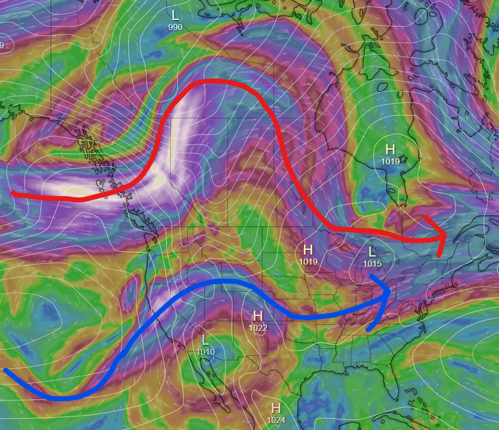
- Pacific high – a high that’s basically always in the Pacific somewhere between the Gulf of Alaska and Hawaii.
- Trough – A line protruding from a low that consists of lower pressure than on either side of it. Basically bumps on the pressure isolines.
- Ridge – Opposite of a trough. Higher pressure line coming from a high pressure system.
- Upper-level trough – Imagine the jet stream is an isoline, and the poles are lows.
- Upper-level ridge – Same, but this time the equator is one big high.
- Polar vortex – A large area of highs around the pole that appears in winter. When a high moves south, it brings January 2024.
- Omega block – A blocking pattern that causes the jet stream to take the shape of the omega symbol (Ω)
With that out of the way, let’s get into it.
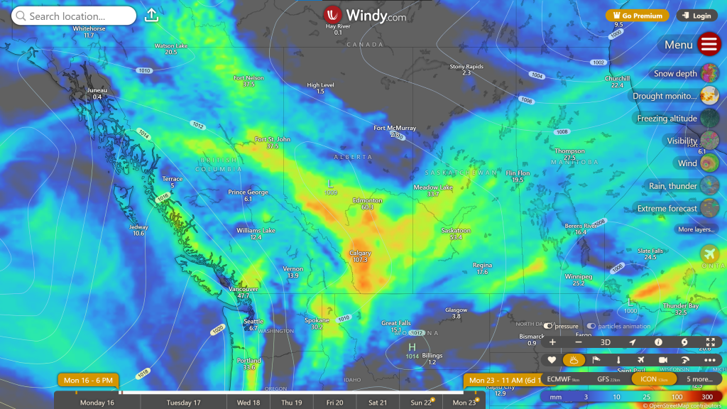
First of all, the Pacific high has been off the coast of the US. This is important, because many models (primarily European ones, for some reason) have been saying it was going to be more northward. This would entirely break the pattern we’ve been having, so definitely take the 7-day+ forecast with a grain of salt. The Pacific high has been creating quite a large upper-level ridge over the western US, which has contributed to heat, but more so severe drought.
The other thing is that the ”””polar vortex””” has been prominent over the northern Northwest Territories. It’s really not the polar vortex, because it consists of lows, not highs. Also it’s July.
Those two patterns have been very prominent over the last few weeks. So, how do they stop heat waves? Well…
Our heat waves want omega blocks. They’re the entire reason July 2024 broke so many records. The upper-level ridge over the western US really wants to bubble up and expand its territory to the Canadian prairies. Every time we’ve gotten heat over the last few weeks, that’s been this high trying to start a heat wave. What’s been stopping it is the complex of lows up north. Every 3-8 or so days, it’s been sending a low through the prairies to then spiral off to Hudson Bay. We’ve already felt this a few times; whenever in the last few weeks we’ve had 1-3 days of clouds and rain after heat, followed by a day or two cool temperatures, that been one of these lows passing through.
So, we’ve had this alternating pattern. Heat bubbles up, then moisture comes for 1-3 days, we get a very brief period of below-average temperatures, then the heat starts to bubble up again. Whenever we see a pattern that’s lasted for a few weeks and keeps reloading, then until it ends whatever the weather has been since it’s started, that will be the forecast.
So then, when will it stop? I looks like it’ll continue for the rest of the month (the only chance is MAYBE around the end). Once we get into August, it’s hard to tell what will happen. I will say, keep your eyes of the second half of August. I do see a possible not heat, but cold wave much longer than what we’ve been getting affecting us then. For now, we’ll have to wait a little longer for an August forecast.