
The following material may contain many terms you are unfamiliar with. This time, I’ll just let you look it up.
We’ve been very lacking in the heat wave department so far this summer, but it looks like pretty late in the omega block season, we may actually get something. Let’s take a look at our upper air forecasts. Here I will supply a “gallery” of images for you, to reference as I explain what’s going on. If you want to see the images better, right click them, and then press “Open image in new tab”.
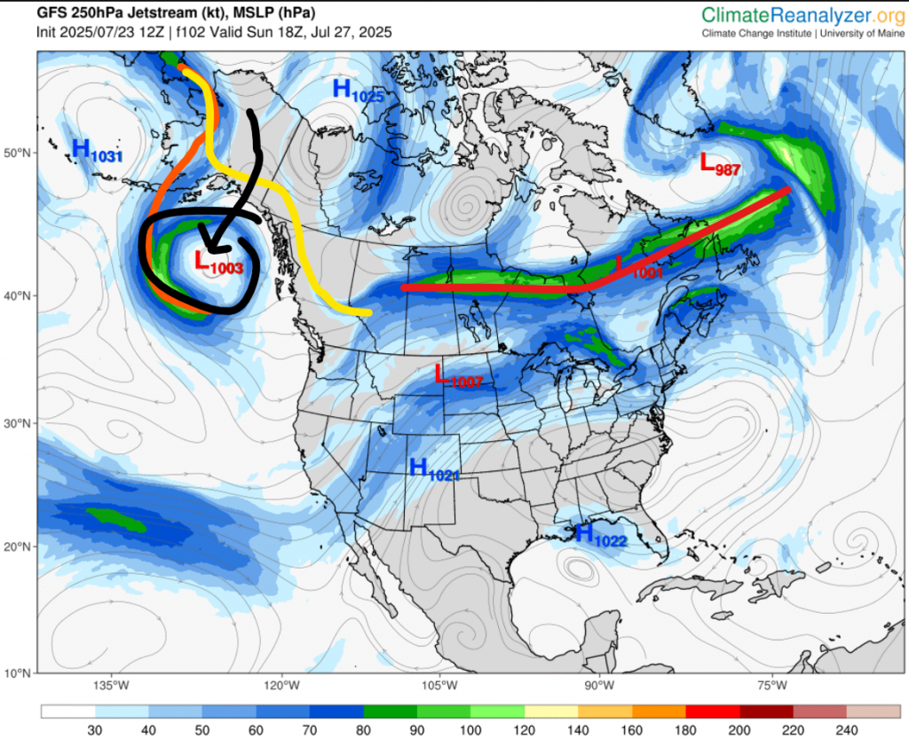
First image: This is the forecast for Sunday. You can see there is a long area of zonal flow (red line). If you didn’t know with zonal flow usually is it sunny near the eastern edge, but then as you slowly go west, it gets cloudier and cloudier to point where there is rain near the western edge. As you can see, we are going to be on the western edge, and this might bring some rain on Saturday night into Sunday. The main thing to look at here though is the low in the Gulf of Alaska. As I have mentioned many times, whatever is going on in the Gulf of Alaska really controls what happens here. A high, low temperatures. A low, high temperatures. This area has been dominated almost entirely by the Pacific high this month, which is why we’ve been so cold. But, as you can see, there is a low there on the map. This low is currently forming in Alaska, and is expected to move south, before stalling in the Gulf of Alaska. The orange line is the jet stream then, and the yellow is the jet stream now.
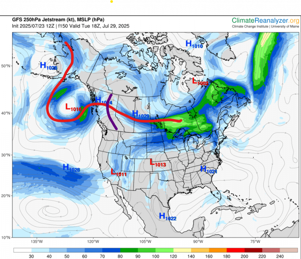
Second image: This one is for Tuesday. Now the low is almost a cut-off low. It has caused significant troughing, which has made way for a blocking high in the southern US to start to ridge up north. This could be the beginning of a heat wave.
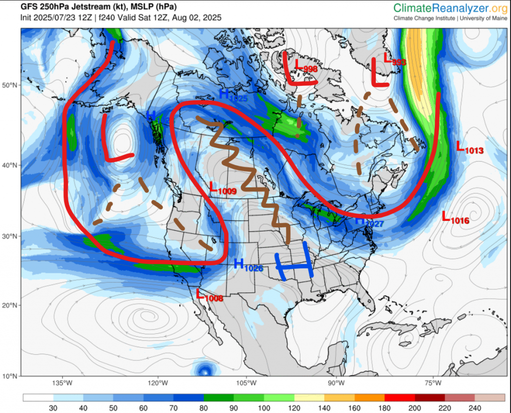
Third image: Now we’re at the start of the first weekend of August. The jet stream made its way all the way down to the subtropical jet, the high has ridged up more, and some lows around Baffin Island and the southern tip of Greenland has also started to trough. This means we have a full omega block.
Now, we must ask, how long will this stay? Well, here’s the interesting thing: It seems the shortwave trough in the third image that is pushing southeast of the westerly low may actually push the blocking high far enough to displace it to be more centred around Florida, which may give the jet stream wiggle room to jump the Rockies at least temporarily. Forecasts have been suggesting a cooldown around the first or second day of the month, but aren’t really sure what’s going to happen after that. Some say the heat will return for another 5 days or so, but others say the omega block may move farther to the east and we’ll suddenly be in a cold pattern. Right now, it’s hard to say who’ll be correct.
For now, that’s where I’ll leave it. I’ll post a short-range forecast on probably Monday, explaining for about what next week could shape up to be.
Come on Gulf of Alaska!! I need a heat wave!