
Hmm… Should there be such a thing as a “Snow wave?”
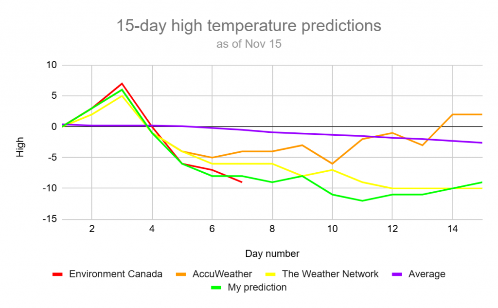
If you’ve been looking at any sort of forecasts lately, you would probably know it’s going to be chilly next week. If you’ve been looking at any sort of forecasts lately lately, you would probably know it’s going to be cold next week. If you’ve been looking at any sort of forecasts lately lately lately, you would probably know it’s going to be very cold next week. Yeah, like a high of -9 on Thursday, from Environment Canada.
To start this off, let’s take a look at what is causing the cold.
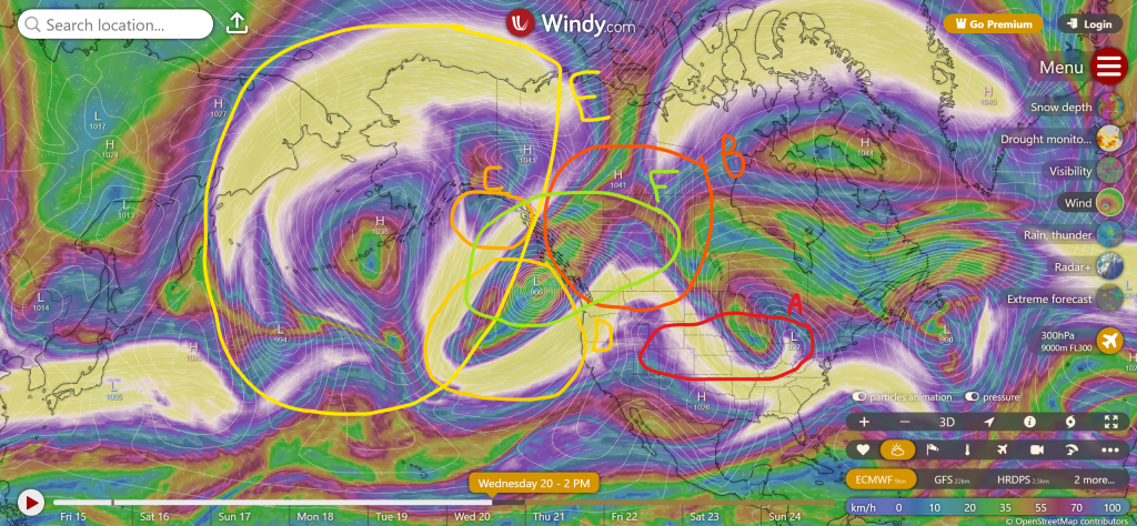
- A – A Colorado low will create the original cold wave. This would only give us one or two days of near to below average temperatures on its own.
- B – This is the area that will get the cold temperatures form the Colorado low.
- C – Here, there is also a low. This would get us very quickly back to average average temperatures as well.
- D – In this area, just as the Colorado low moves off, a low will suddenly form and strengthen to an extremely strong low in record time. This is likely from perfect conditions that will be prevalent; near the jet stream and low wind shear. This low will also push off the high that’s almost always in a certain spot in the Pacific Ocean. This is a very rare occurrence. It will also stay in one place for a long time.
- E – Here a big ridge will form early to mid next week, but the extremely strong low will keep blocking it from reaching us, eventually fizzling it out entirely, while de-intensifying to low a bit.
- F – This area will stay at cold temperatures long-term. It will likely last until at some point in the last week of the month, but that’ll vary for different areas.
If you were wondering about the actual forecasted temperatures, here they are:
Well, it’s looking cold! Maybe even snow as well. For that, we’ll wait until we closer to any big events, and then I’ll post something for that. Maybe also an update for the cold at some point. For now, we’re done!