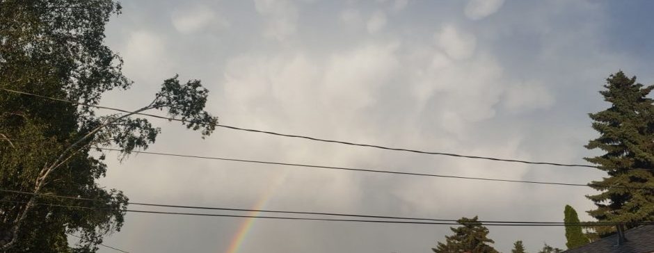
A slight cooldown complete with snow tomorrow!

After a quite toasty 10 degrees today, it’s looking like our heat wave is finally coming to an end!

A strong high to the far north is moving down, and through the power of ridge and cold front is going to quickly cool us down to average temperatures this evening, and keep it there long after. All this northerly wind in the prairies will then kick up an Alberta clipper which may bring us some precipitation.

Tonight, low pressure dominant over the southern half of the province will keep things cloudy with near average temperatures. Overnight, as the Alberta clipper develops, we might see some early very light flurries or ice pellets, or even a tiny chance of freezing rain around 5 am. Over the day tomorrow, snow will begin ranging in intensity from a few periods of flurries to steady snow. There is a chance of a little rain mixed in because of a near-0 high, but it is unlikely it will actually be a significant amount, if any. The snow will continue into the evening, but it should fully taper off by Monday morning.

After this until Wednesday; average temperatures, light winds, and no precipitation will continue. For clouds; during the precipitation we will see stratiform clouds, likely nimbostratus; then clearing away on Monday to patches of cirriform on Tuesday.

Posted in Forecast, Precipitation, Temperature | Leave a comment

Winds and warming!

Hey! I’m back once again after another long break from the blog. I’ve been thinking the current way I’ve been posting things here is maybe not working out. I could possibly stop doing the whole this post is short range, this one is long range; and trying to constantly have the latest forecasts for those. I did it for a while, but I just don’t have time to do that all. Instead, I might start doing a bunch of different, maybe more messy sort of stuff. You might get a post for the next 2 days that could start suddenly talking about next month, and then the next one 10 days later that says nothing about the latest forecast at all, instead doing something completely different.

Anyways, let’s get started. Unless you’re Patrick and you live under a rock, you would probably know that we’ve been in a cold wave for about five months now. Oh wait, that’s just what it feels like. It’s actually only been 2 and half weeks. It started in January, which somehow is also over half a month behind us already. How did that happen!? This cold wave has been caused by a high that has been kind of just sitting around, doing not much over the prairies for about forever, but finally starting tonight it is moving down south. This will warm us up, with us set to finally be back in the positives on Wednesday.

Now, I have a challenge for you. Using some basic weather knowledge and some information in the forecast I want you to see if you can predict something as seemingly random as the wind direction. What I want you to do is make a prediction of how the wind will behave over the next few days. Here is a list to help you:

  • Around high-pressure systems winds flow clockwise. Around lows, counterclockwise.
  • Winds flow outwards from highs and travel to lows.
  • We have a strong high in southern Saskatchewan right now, but that will move down to the central US by Wednesday evening.
  • There is a strengthening high in the northwestern corner of the US.
  • Finally, tomorrow night a ridge going north from the Saskatchewan high will very quickly dissolve and low pressure will move in to the northwest.

See if you can figure it out! At the end of this post, I have the prediction on the forecast and why the prediction is that way. You might not want to read that just yet, and wait until Wednesday or Thursday to do so.

Okay, that was part one of the activity. For the next part, you will get to test your prediction. The next time you go outside I want you to note the wind direction. If you need to to remember it, you can write it down. Next, tomorrow evening note the wind direction again. Finally, do it one more time on Wednesday. For each of these notes, either in your head or on paper, you can use cardinal directions, which in that case go with either two, or preferably three “digits” (That would be like NNW). What you might want to use though instead is landmarks. Chose a memorable spot to measure the wind direction, and point towards where the wind is coming from. You can then find a landmark you are pointing at. You might want to close your eyes for getting the direction, because interestingly that usually gets a more accurate reading.

Okay, well you might not want to read this next part, as it may change your prediction. That’s not what is wanted! Come back here after you’ve made your final observation on Wednesday.

The first two items in the list are rules of weather. Those always happen worldwide*. The high, as it says, is moving south. Because of that rule that definitely didn’t get a extremely shortened but still very long footnote, the wind should be moving from the SE to SSW right now. As of writing this, we have southeasterly winds. As the high moves south, it will veer the winds, but the ridge (mentioned in the last item in the list) will keep it in place where it is. However, it does say that the ridge will quickly dissolve tomorrow evening, meaning the wind will change then. This wind will start coming from the Rockies, and the second-last item says there will be a high there and a low to the northwest. This will really reinforce the winds, meaning that tomorrow evening they should be southeasterly, but on Wednesday southwesterly.

If the forecast was right and you were right, good job! You were really good! If you were wrong and the forecast was right, then pay attention to how the forecast is explained above. After just a bit of reading, you should be able to understand what you missed. If you were right and the forecast was wrong, you either got really lucky, or you’re really smart. There’s no way for me to tell right now. Finally, if you and the forecast were both wrong, then, well, it’s also hard to tell. If your prediction was different from the forecast, then the weather just didn’t want to cooperate with anyone. If you’re prediction was the same though, you still get a lot of points. The weather sometimes does really unexpected things!

*Except the first one gets flipped in the southern hemisphere because the Earth is a sphere and it’s rotating and wind flows in certain patterns on the surface and it flows vertically and there’s patterns in all layers of the atmosphere and there’s cells that form bands of patterns in wind and temperature all over the surface and atmosphere because of pressure inversions, temperature inversions, and a whole lot of other stuff that we’re NOT going to talk about today. If you want to sound smart, it’s called the Coriolis effect.

Posted in Forecast, Forecasting activity!, Wind | Leave a comment

Quickly warming weather coming up this week!

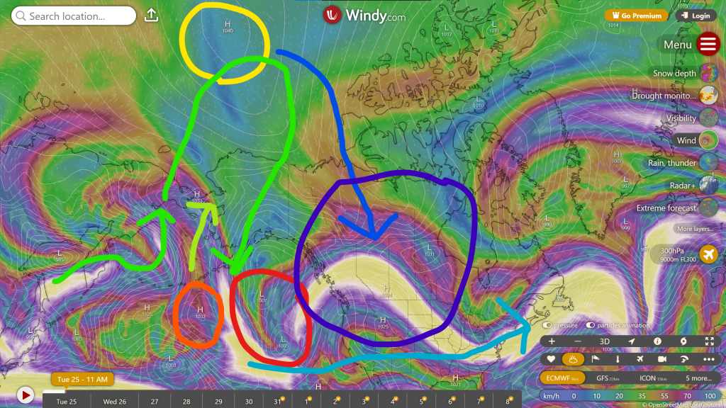
Once upon a time, there was a high. This high currently is in the Canadian prairies, where it’s enjoying its few days in comfort, bringing quite cool weather to Alberta, but maybe a little too cold of weather basically everywhere else in this half of the country. (Regina got a wind chill of -38 last night) This high originated up in the arctic, where it formed part of the polar vortex, along with its similarly cool friends. It did, however, have a dream of one day of setting up a farm and living a great life growing and harvesting crops, and living off the land, but this northerly soil was just simply not fertile enough for that. So then… only a few days ago, it finally decided to move south, looking for a more feasible land to plant in. It is a hard endeavor moving such a long distance, but so far the high is already halfway there. It should be there by about tomorrow evening.

Of course, when two highs separate, trouble usually follows! A mischievous low has been watching the high and waiting to unleash it’s plan this whole weekend! This low has really been wanting that land for it’s own plans, but the high snatched it up before this low could actually get down there. Now that high has to go. It must be rid of, so this land can actually be put to good use.

The low has already started to unleash it’s plan, by beginning with making a trough extending from it’s home- just north of Alaska- all the way down to at the moment about Yellowknife. Tonight it will extend this trough to about northern Alberta, before then sending out a smaller “minion low” tomorrow to secure the area.

Over Tuesday, this minion low will continue to move through Alberta and Saskatchewan while securing the land before heroically getting sucked up by some highs about the moment it gets into the US. This will mean temperatures nearing 0 for a high on Tuesday. A little wrap-around precipitation may be left behind, so we a chance at precipitation Tuesday night. On Wednesday, some allies of the high will manage to “ridge up” jet stream a bit, but not enough for a significant amount of cooling. It is still supposed to be slightly cooler.

By Wednesday, the low is growing restless. It must capture the land and force out the high. The low will take a very dangerous move: It will slide all the way over into the prairies, ready to fight for and win its land. The highs and lows will soon clash in an extraordinary mixture of temperatures spread out over the whole western half of the country! Once that’s nearing an end, one high- the original high- completes a daring move on Thursday night; it makes a ridge! This ridge pushes away the low with much, much force, now making the low stuck in Hudson Bay. It wanted land, not water!

Now that the high has triumphed, it can finally set out to what it wanted to do, while sitting back and watching the ridge slowly dissipate and the prairies descending back down to a cold wave. The end.

Posted in Forecast, Temperature | Leave a comment

Top 10 weather events of 2024

I’m back on the weather blog! Here’s a special post for the top 10 weather stories of 2024.

10. Early April heat

Around the start of April we had a quick heat spell, and we managed to get a very early first 20 degree high on April 2nd. This also came with 4 positive lows! It was probably a very quickly moving system, because only a few days before and after the 20 degree high the temperature was actually a little below average. The typical first 20 degrees happens around the end of April.

9. June rainstorm

Rain poured down hard on June 3rd, 2024, when we had 30.7 mm of rain in just one day. It happens that on that day in 1888 we got a slightly stronger rainstorm, so we didn’t get a record, but we were close!

8. Partial solar eclipse

On April 8th, 2024, North America got a total solar eclipse. Here in Edmonton, we had only a partial eclipse, but it was still nice to watch. (If you had eclipse glasses or an an eclipse viewer)

7. Weird smoke stuff

Usually May and June are pretty bad months for smoke, but in 2024 we actually had very good air quality in these two months, except for about 3 days in May. It was probably the best smoke conditions in any Edmontonian June for a long time, if not ever. It highly contrasted 2023, which had a exceptionally harsh wildfire season. To make for these clear conditions, we did get some big blasts of smoke in July and August, and that definitely took a lot of people by surprise, knowing it was coming from no smoke for over a whole summer month.

6. September heat wave

September kicked off with a massive blocking high that stayed around for days on end. We had five whole days of 30 degrees in September, which as far as I know is the most we’ve ever had. In the rest of September, we had very warm temperatures all the way through, with 4 distinct heat waves. We also had very dry conditions, which was quite a change the 69.5 mm in August.

5. Lots of aurora

March through October last year brought insane amounts of aurora, to the point where in the usually least active month of the year, we got more auroral events than we’ve ever had in the most active month of the year. Plus, in May, we had the strongest aurora storm in many many years on the 11th – 12th. If you want some stats, 2023 had Aurora Watch issue 24 alerts, and 2024 had 53. To make it even more extraordinary, 2023 already had significantly above normal solar activity.

4. February snow and cold

In late February, after a very mild and dry month, we very suddenly snapped to cold temperatures, and 14 cm of heavy snow in just one single night. Just 12 hours of snow amounted to 68% of the total precipitation of the entire month! After the snow, highs were around -15 for about the next 10 days.

3. November cold wave

Out of everything on this list, this one is the most recent. We managed to have a very prolific low block everything that try to stop it for about two weeks. In that time, we got cold, but not super cold temperatures, and an overall lowest temperature of -25. Of course, two days after that -25 we were suddenly at 7.1! An interesting thing with this cold wave is that we got quite a bit of precipitation, with the most snow in one day for all of 2024 on the 23rd, which ended up being the most precipitation on any November day in >20 years, and also 8 whole days with a measurable precipitation amount.

2. January cold wave

This was the main cold event of 2024, when temperatures professionally dived to -37.7 with a wind chill of -45, which occurred on January 14th, and a total below average streak of over 3 weeks. I can remember this happened when the polar vortex absolutely smashed the prairies to pieces with all this cold by basically temporarily moving to Canada from Siberia. What makes it even more crazy is that pretty much all of the previous November and December was chalk-full of positive highs, which had made the warmest November and December ever for Edmonton.

1. July heat waves

The number 1 weather event of 2024! Here it is:

After a quite cool and rainy June, the weather noticed it was summer and rocketed the temperatures way beyond what records had previously set. The highest temperature was 36.2 degrees, and a humidex of 39. (Which actually happened two times, 11 days apart) We had 11 total days of 30 degrees in July, which devastated many farms and is the main reason that the smoke came back. We broke a total of 14 heat records over the month, with 6 for the highest temperature, and 8 for the highest low.

Well, this is the end of list! I hope you enjoyed.
Posted in Aurora, Past weather, Precipitation, Temperature | Leave a comment

Cold wave update: Ups and downs, but still below average

The temperature patterns are turning out very interesting, with the possibility of a -20 low, followed by a -5 high the next day.

Overall, it looks like temperatures will be cooling over the next few days, with a once-again possible -15 high and -20 low, and the a very sudden perk up as a rapidly disintegrating upper-level ridge slightly intrudes on our territory. It will still be below average, just not as much. Then, as soon as it came, we’ll be back in the possible -15 high and -20 low range. That for only a few more days, and then it looks like November 30th will mark the end of the cold wave, before temperatures are forecasted to go up again. This would mean, if correct, that our cold wave will be a total of 12 says long.

Interesting to see what’s coming. For the snow that’s coming soon, check out the post 2 before this one, of just go to the latest short-range forecast.

Posted in Forecast, Temperature | Leave a comment

-12

Tonight and tomorrow, the temperature will be very abnormally stable near -12.

Here’s what is looks like:

Okay, that’s it! Just wanted to quickly mention a really weird temperature anomaly.

Posted in Forecast, Temperature | Leave a comment

Very big and unusual snowfall event tonight through tomorrow night

This one is very unusual because we are getting a LOT of accumulation with temperature below -10, in late November.

A strong, prominent, and slow-moving trough will create very long-lasting snowfall, likely accumulating about 15 cm. Snow is expected to begin to fall this evening, and last until tomorrow night. It will be the heaviest during the day on Saturday.

Most forecasts have the accumulation amount near 15 cm. It does seem though that it could end up as low as 10. However, the upper end is massively farther with the highest estimating 25 to 30 cm. If we get that much, this would probably be one of the biggest snowfall events of the 2020s!

Watch out for very snowy conditions for the next while, especially Sunday. The main thing about this is, the snow will probably not even begin the melt until December, because this cold wave is looking like it will keep temperature below 0 for the rest of the month. This means, whatever we get now will probably stay for at least a month.

Posted in Forecast, Precipitation | Leave a comment

Here’s your winter forecast for 2024!

Finally we have a long-range!

Overall, it looks like this year we’re going to have a weak La Niña, with oceanic Nino3.4 SST anomalies (aka the temperature of the ocean in the area measured for El Niño/La Niña) looking 1.5 to 2 degrees below seasonal. Basically, that means below normal temperatures for this winter.

Overall it looks like alternating cold and heat waves, with cold ones more frequent. The strong heat waves will still occur and it may even amount to cold and heat records not far apart. This also means maybe a few fool’s springs in January and February as well.

As well, there will likely be at least some snow associated with every cold wave, meaning much more snow cover than last year’s very mild winter. This will mean that, paired with sufficient spring rains, we will probably see the wildfire season of 2025 quite a bit better than even 2024.

After this winter, it does look like temperatures will increase once again likely amounting to a near average or a possible weak El Niño for next season.

Posted in Forecast, Precipitation, Temperature | Leave a comment

A big cold wave is coming!

Hmm… Should there be such a thing as a “Snow wave?”

If you’ve been looking at any sort of forecasts lately, you would probably know it’s going to be chilly next week. If you’ve been looking at any sort of forecasts lately lately, you would probably know it’s going to be cold next week. If you’ve been looking at any sort of forecasts lately lately lately, you would probably know it’s going to be very cold next week. Yeah, like a high of -9 on Thursday, from Environment Canada.

To start this off, let’s take a look at what is causing the cold.

  • A – A Colorado low will create the original cold wave. This would only give us one or two days of near to below average temperatures on its own.
  • B – This is the area that will get the cold temperatures form the Colorado low.
  • C – Here, there is also a low. This would get us very quickly back to average average temperatures as well.
  • D – In this area, just as the Colorado low moves off, a low will suddenly form and strengthen to an extremely strong low in record time. This is likely from perfect conditions that will be prevalent; near the jet stream and low wind shear. This low will also push off the high that’s almost always in a certain spot in the Pacific Ocean. This is a very rare occurrence. It will also stay in one place for a long time.
  • E – Here a big ridge will form early to mid next week, but the extremely strong low will keep blocking it from reaching us, eventually fizzling it out entirely, while de-intensifying to low a bit.
  • F – This area will stay at cold temperatures long-term. It will likely last until at some point in the last week of the month, but that’ll vary for different areas.

If you were wondering about the actual forecasted temperatures, here they are:

Well, it’s looking cold! Maybe even snow as well. For that, we’ll wait until we closer to any big events, and then I’ll post something for that. Maybe also an update for the cold at some point. For now, we’re done!

Posted in Forecast, Temperature | Leave a comment

The recent heat wave got us a record! How did that happen?

High-pressure system, or anticyclone. Which one do you use?

From November 6-9, we had highs of 10.6, 14.3, 15.6, and 7.3. Each was at least a few degrees above average. We even had the very rare 5 degree November low on the 7th! That low of 5.2 collected us a record for the highest low.

The setup for this was a naughty little high to the south and low to the north. The high created a large ridge, and also pushed warm air up to the northerly low. This created very warm temperatures for a few days.

The heat wave was also odd because it was bordered by short cold waves on either side, which both brought highs to near 0.

Posted in Past weather, Temperature | Leave a comment