With it only being early August, and quite an anomaly of the last four summers, it much more likely than you would think!
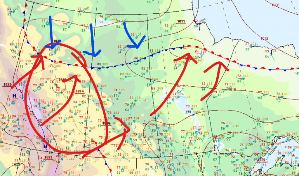
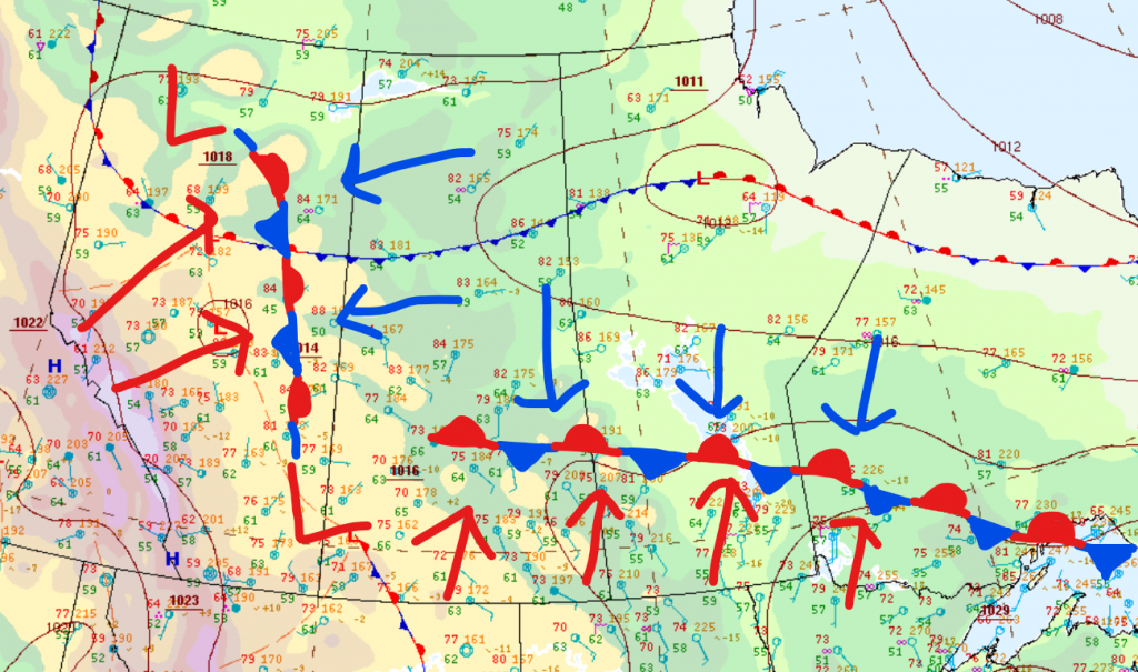
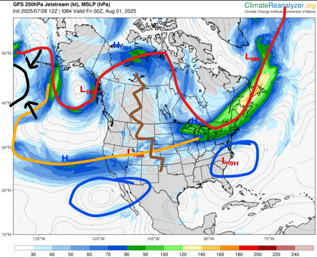
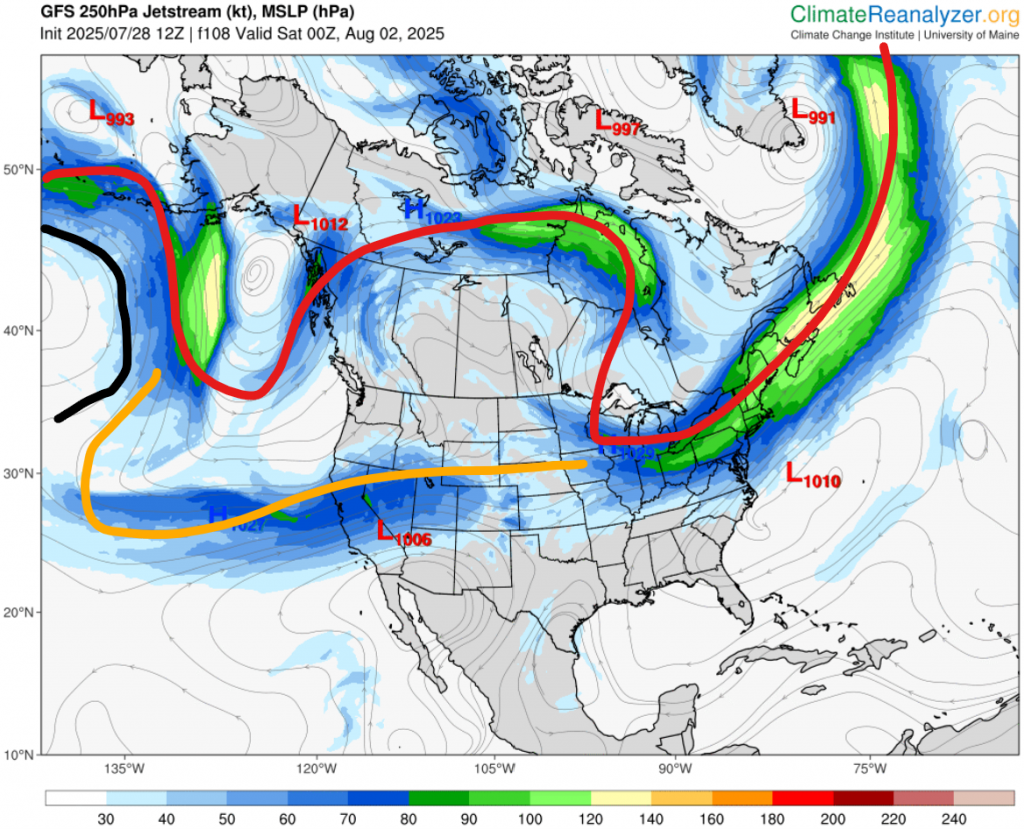
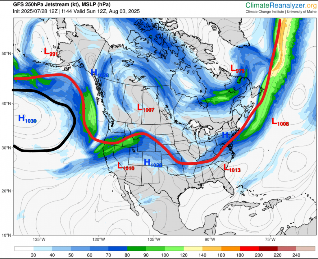
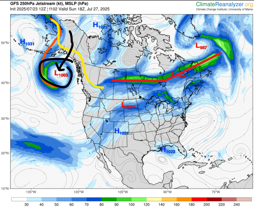
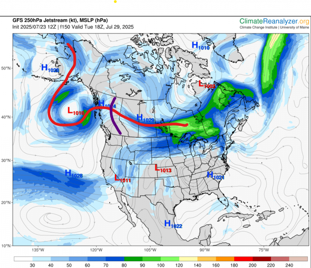
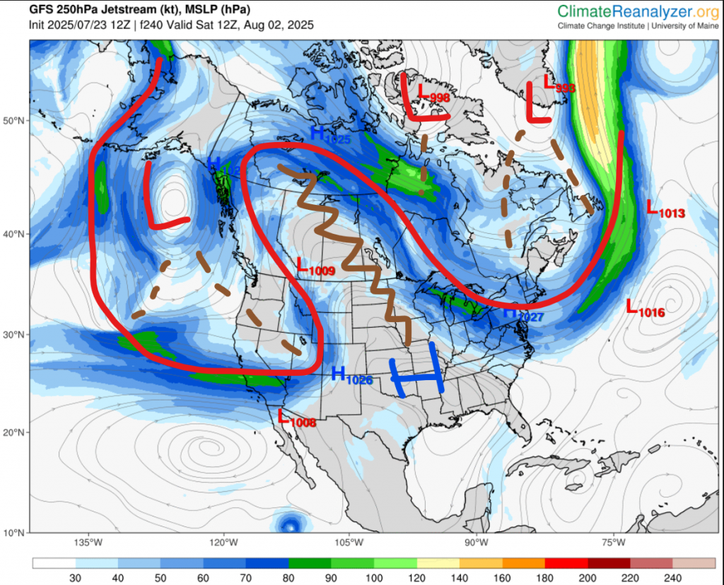
The main reason I’m writing this is the pattern. Oh, the pattern. The pattern we’ve had since June, where highs try so desperately hard to create a ridge, before being completely swept away by round of lows coming all the way from the Bering Sea, bringing temperatures down to high-teen highs, and sub-double-digit lows; along with some rain and thunderstorms. Going into even September, this pattern shows no signs of stopping.
Well, let’s take a look at pretty much our whole weather overview in the next month is right now. Currently, we our in some cold. Not very much, but not too little. It seems we’ll be back to mid 20 highs on Saturday. For Saturday through maybe Monday maybe Tuesday, temperatures will be slightly above average. Sort of 24 to 28ish. I really don’t think we’ll get 30 degrees; Environment Canada says 27 for Tuesday, and AccuWeather 26; but it still may happen. After that, Tuesday/Wednesday all the way to the end of next week, we are set for a cold wave. Early next week, sort of 17th to 19th, I do see another heat wave potential, but it seems another through is going to some through starting around the 20th. Once we get past the 20th, it gets pretty uncertain. The models really aren’t sure where and when the troughs will come through, so pretty much after 14 days ahead they just get really washed out. This is what they’ve been doing this whole summer.
Now we have to talk about AccuWeather. I think I’ve mentioned this once or twice here before, but AccuWeather has a 3-month daily forecast. Past 10-14 days, the forecast isn’t great there, but not horrible. Around a month ahead, It actually gets really bad. I’ve noticed it usually ends up being the opposite. But, for some reason, I have no idea why, but for 5-6 weeks ahead its accuracy goes up. I just want to mention it, but it seems, based on this, the pattern will probably continue into September. After 6 weeks ahead, it get really bad again, but you can’t blame it. That’s basically impossible to predict.
In all, I would say the probability of us not seeing any 30 degrees for the rest of 2025 is 30-60%
One last thing; next week I am going to day camp. It is from 9 am to 5 pm (I think) each day for the whole 5 days. This means there will be no evening forecasts, and probably no posts on the blog as well.