After a pretty average weekend, temperatures are expected to get back up to above normal, but not by much.
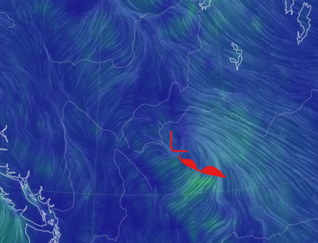
It will start around midnight tonight, when a warm front will come through:
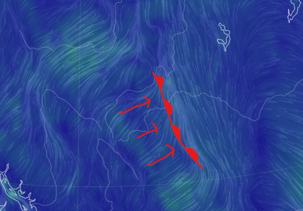
This will raise temperatures by a few degrees, and bring in a warmer airmass. There might be precipitation along the front, but most likely we won’t get anything.
For the next few days, expect highs around 13-15 and lows around 3-5, with the exception of tomorrow night, when we may actually reach the negatives.
On Wednesday night, a low will pass over southern Alberta, and some precipitation may reach here. Here’s another map:
After that, expect a quite warm Friday, with a high getting into the high teens. After Friday, it seems we may end up diving into a cold wave.
But what is the reason for all this? Well, it’s going to involve many more maps:
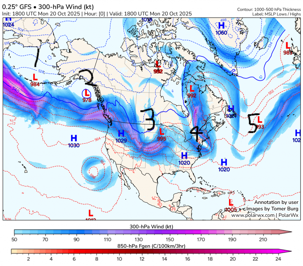
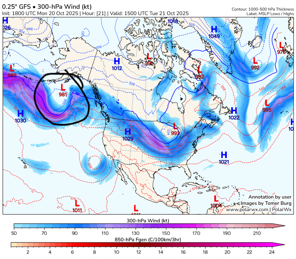
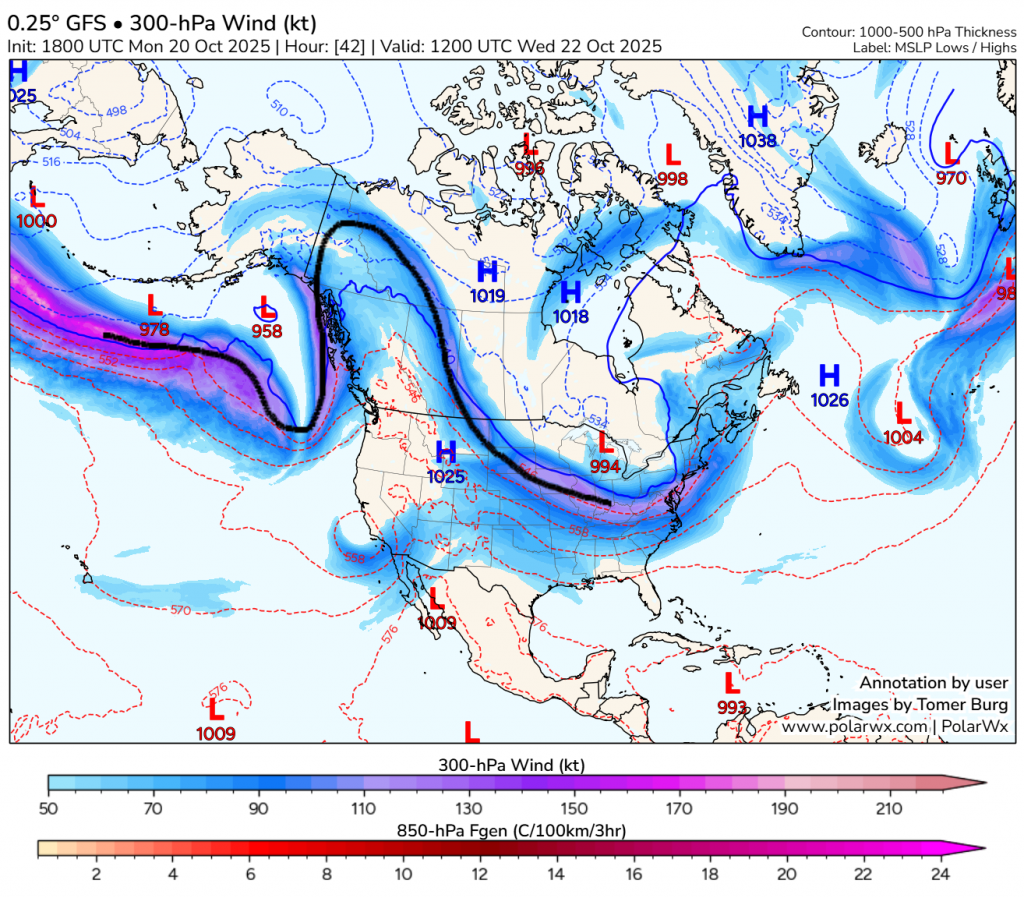
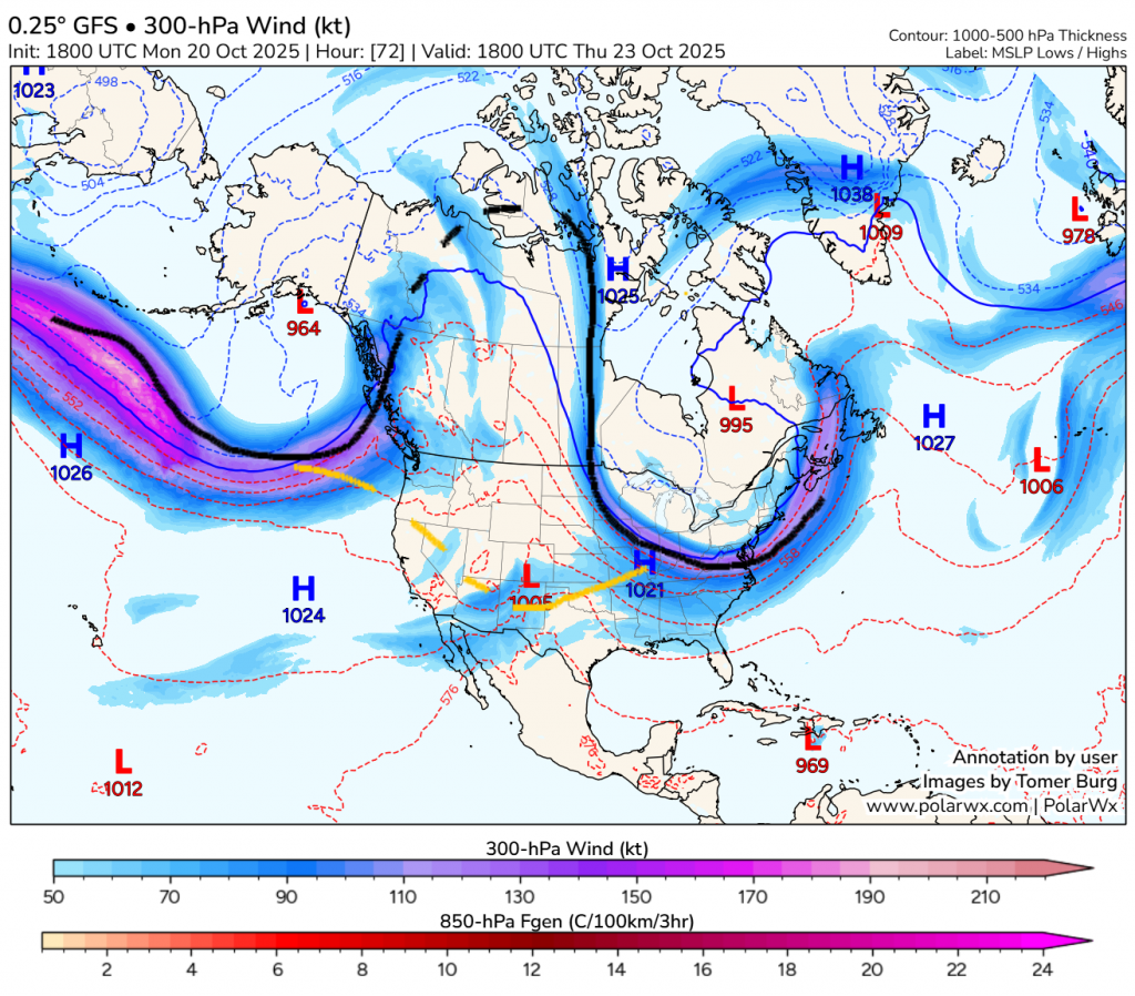
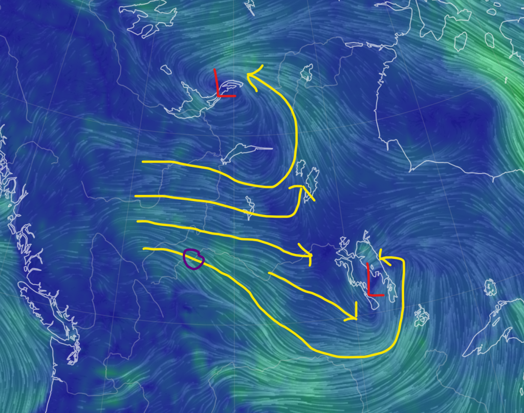
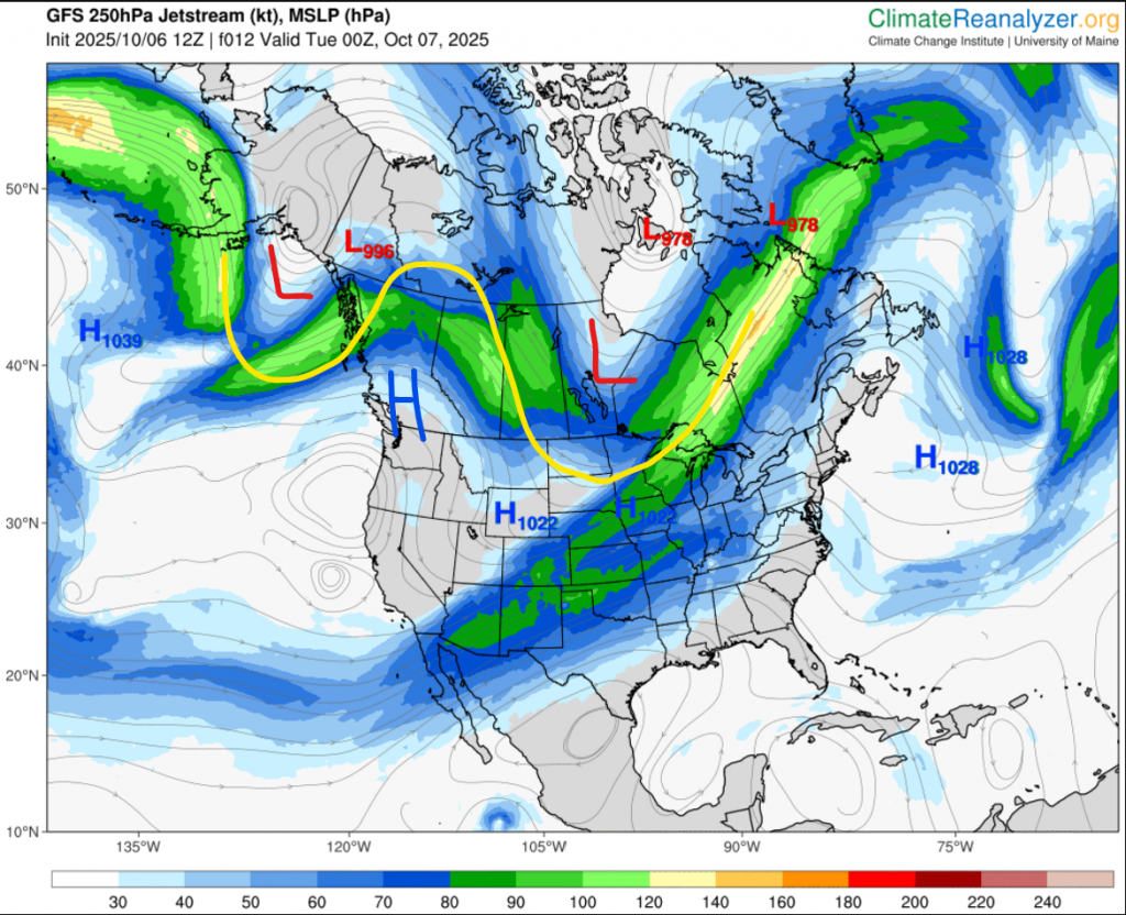
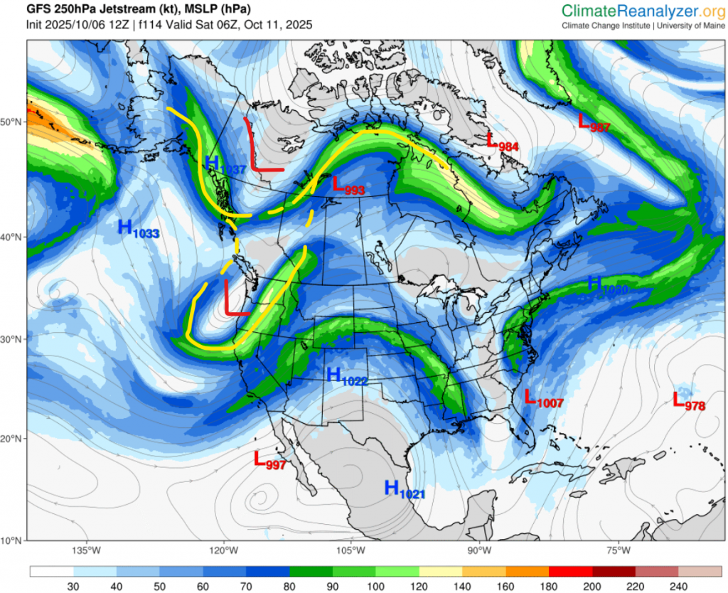
First of all, let’s start with right now; the first image. The upper-level flow has been very active lately, with rounds of lows circumnavigating the globe. As you can see, we can find 5 on the scope of the map. On the second map, now for tomorrow’s forecasted conditions, we can find low #2 has dissipated, while #1 has strengthened. As this low continues to strengthen, ridging begins on the west coast and quickly balloons to what we can see on the third map, for Wednesday. This is the usual pattern for North America; if there is a low in the Gulf of Alaska and nothing is blocking ridging on the west coast, it will happen.
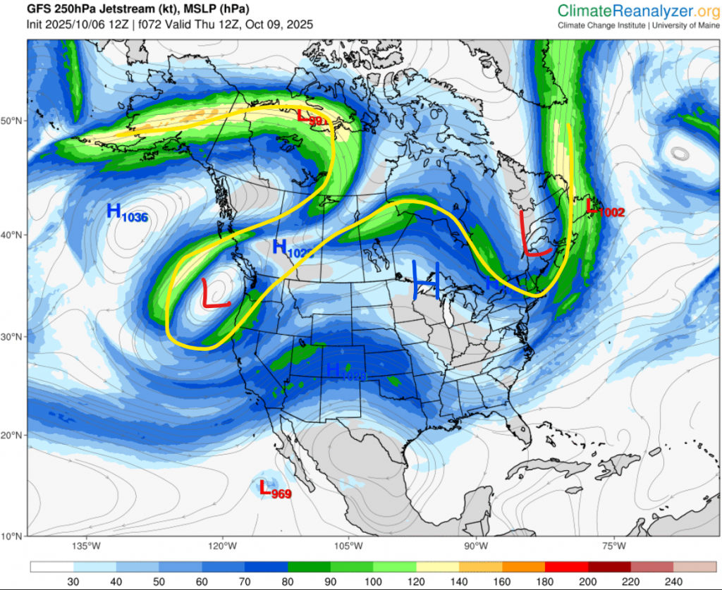
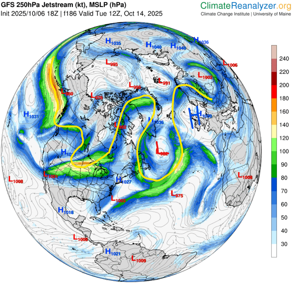
This ridge isn’t strong though, so the heat won’t be as well. In the fourth picture, now for Thursday, we also find a weak subtropical jet is trying to form. We can also see the main jet stream seems to be breaking up a lot at the top of the ridge, which is normal for weak, tall ridges that are starting to decay.
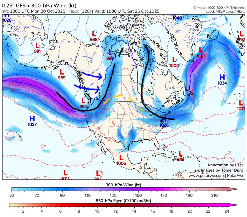
As we get to image 5, for Saturday, we see the very small hint of a subtropical jet stream is gone, but another weak bit of flow connecting the bottom points of the ridge are connecting a bit. The jet extension (strong, zonal flow) from Siberia is pushing the stuck low over to here, and temperatures will drop quickly after the end of the work week.
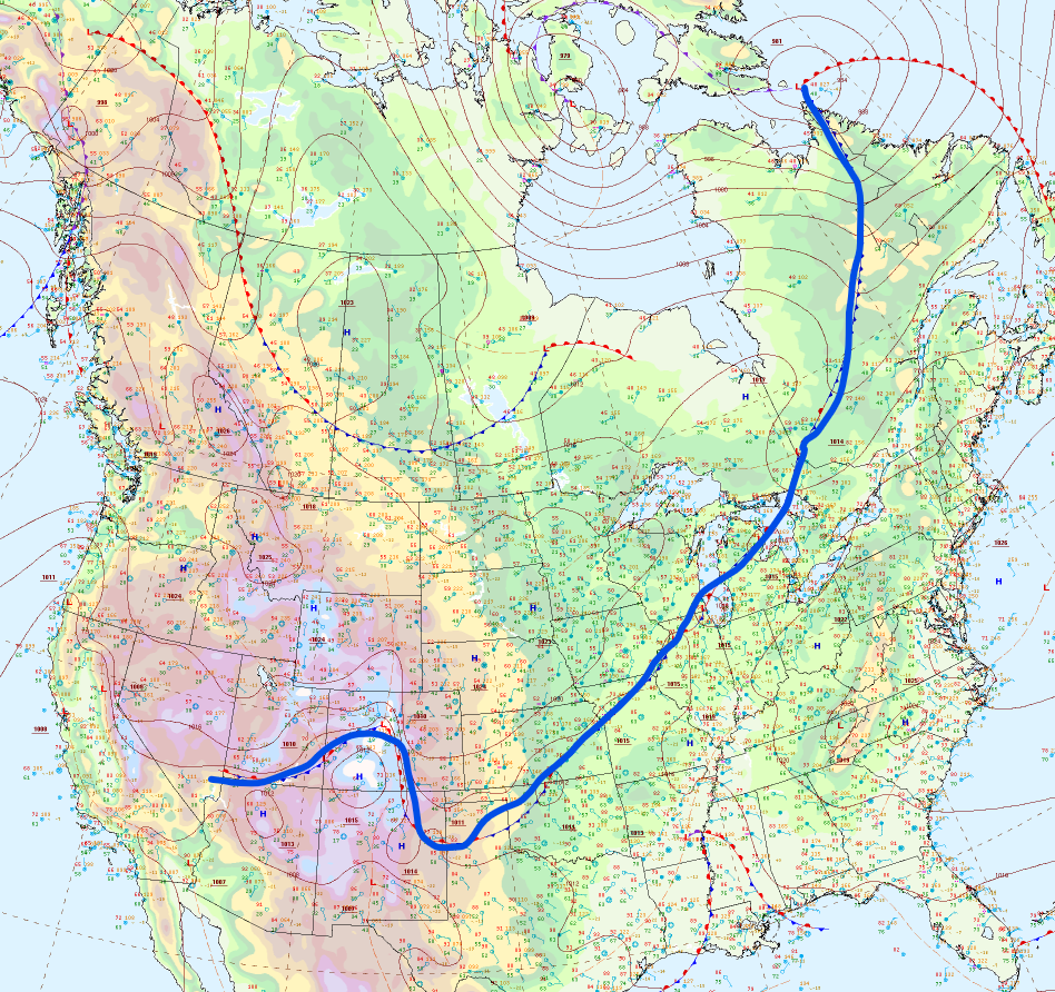
Some of you may be wondering what all the red and blue dashed lines on the maps are, so here’s an explanation. They are contour lines for the distance between the surface and the altitude at which the pressure reaches about half of that. It is generally warmer when that value is higher, and vice versa. If you look very closely, you may be able to see some numbers on the lines, which is a value at the contour in decametres. The thick blue line at 540 is approximately where rain will change over to snow.
Well, that’s it for today! No posts tomorrow, but I’ll be back Wednesday.