Here is where the latest medium-range forecast will be kept, for quick access.
Generally, a medium-range forecast is 5 days – 1 month.
Finally, it seems the heat will end, and winter will return…
(Posted Feb 10)
Hello everyone! It’s been quite a while since I’ve posted on here. Not very much is happening right now in the short range, but just beyond that, oh boy do we have something coming.
Let’s start with the GFS model, showing 500 hPa geopotential height (for the people who don’t know what that is, just the altitude the pressure reaches about half of that of the surface), and air pressure at the surface.
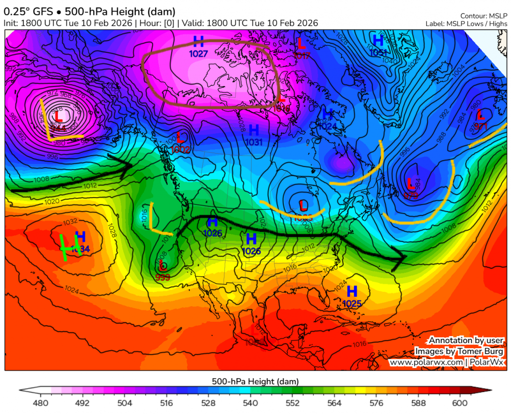
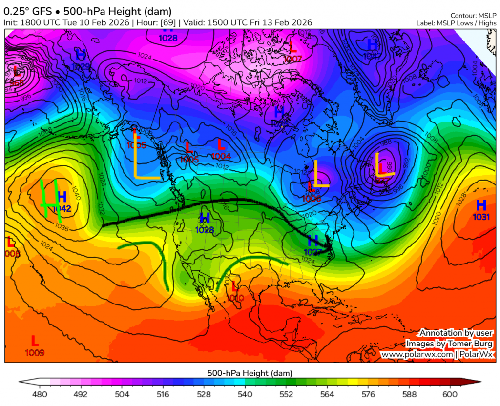
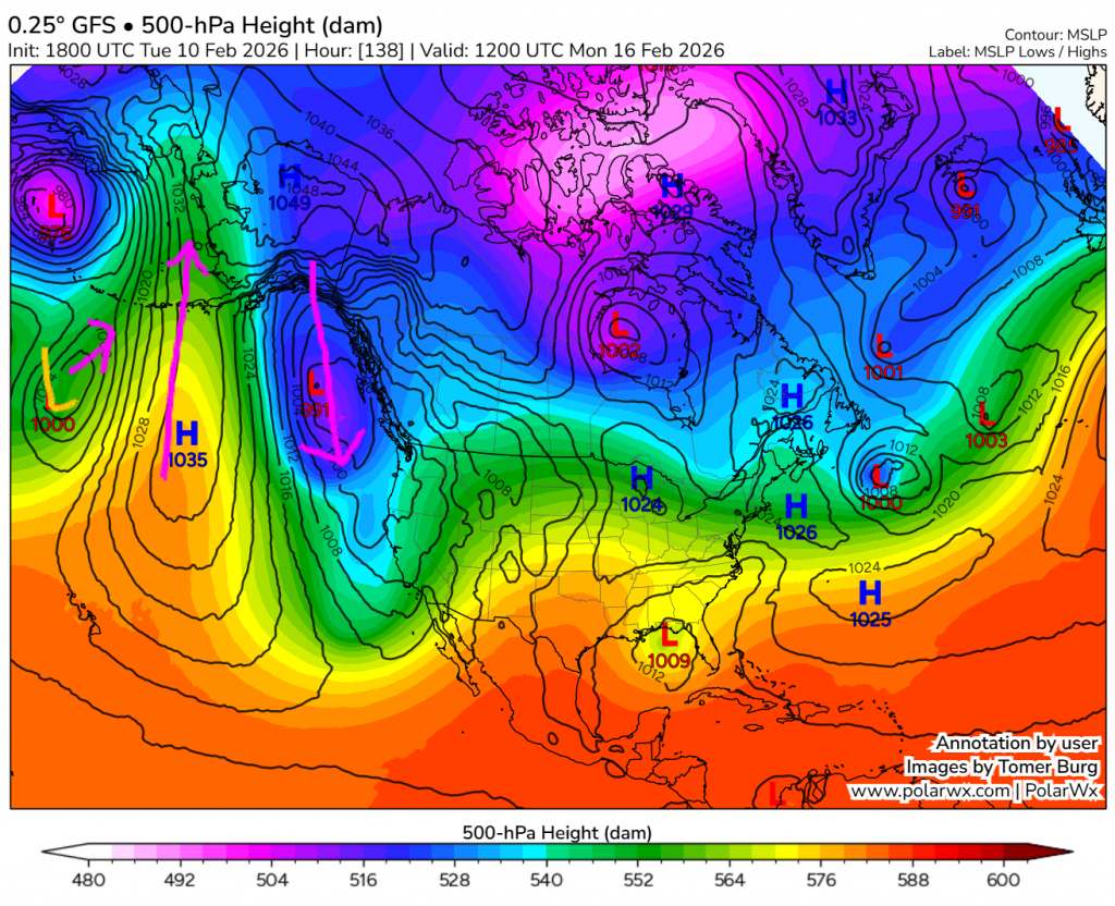
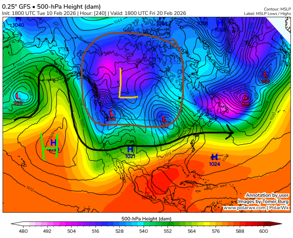
For some reason, WordPress decided that that last image had to be really big.
Let’s start with the first image, which shows conditions right now. Flow is screaming through the Pacific, as it is being tightly squeezed through a deep high and deep low. A lower-pressure area is present off the west coast of BC/US, and moderately strong mostly zonal flow resides over the majority of Canada and the US. The polar vortex is centred over the Arctic, as shown in brown; and across the Atlantic troughing is prominent.
The second image shows forecasted conditions for Friday. In the Pacific a large ridge has built (which will get our PNA quite negative), and over North America ridging dominates in continental regions, while the coasts have troughing.
On the third image, we see over the weekend a low will intrude on the big Pacific high, pushing a lobe far northward. Because suddenly a bunch of warm air is all the way up there, the polar vortex must adjust and send a bunch of the cold air down just after.
That will sure mess up things far a few days, so the final image is for 4 days later. The Pacific high is still present, and a large polar vortex lobe is now over western and northern Canada.
That’s where the GFS forecast stops. That GFS forecast was only a singular model run, so far our there may also be some artifacts that don’t end up happening. We can fix both of these problems by switching to the ECMWF ensemble. Through the whole scope of the GFS model we just looked at, it is surprisingly quite similar, even far out. The ECWMF ensemble does go 5 days farther, so here’s a map for then:
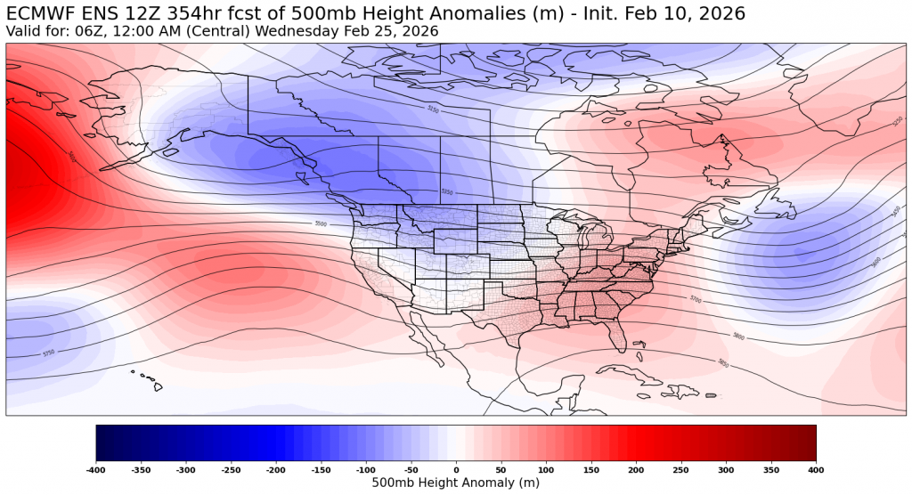
As you can see, it’s more likely than not going to take until March to get rid of this cold wave.
Finally, let’s look at some temperatures. We’re back to singular model runs, this time using the mainstream ECMWF model. Here is the temperature anomaly for the next 5 days:
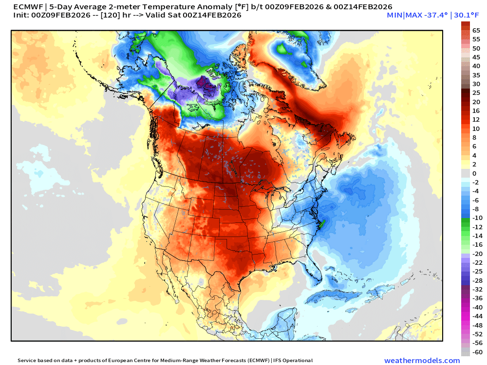
As you can see, quite warm for us. Now, let’s look at the time frame for the Feb 15 – 20:
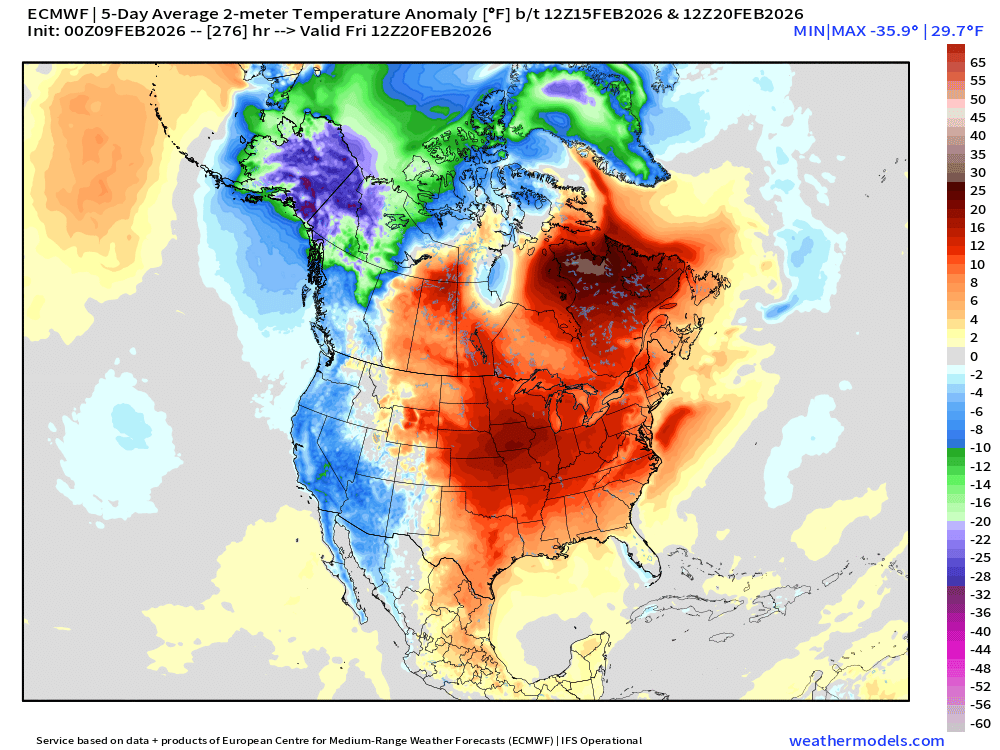
Also above average, but much less so. Since the cold seems to be approaching us, we will probably start that time frame above and end below. Finally we go 5 more days ahead and we get this:
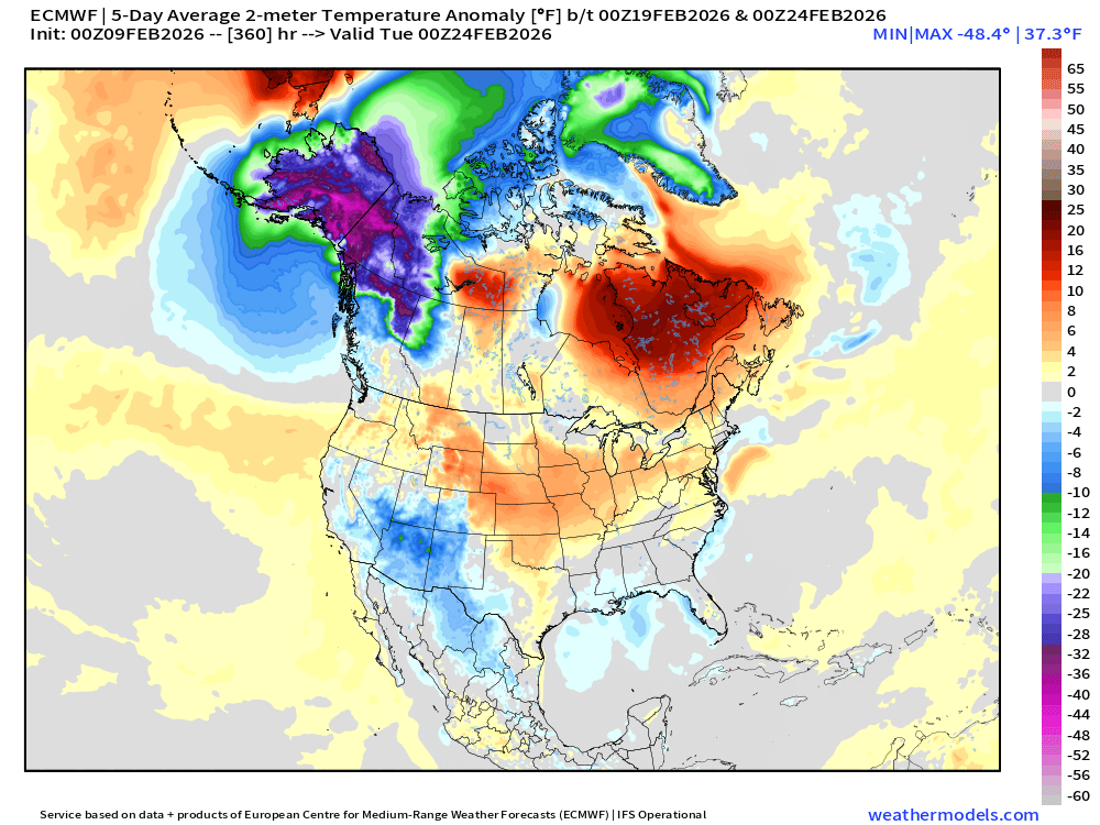
Looks like that cold is seeping in!
If we keep going, we’ll have to use some extended ensembles, which are not too accurate, and I won’t show them here. They do seem to be forecasting temperatures to get progressively colder over the month, before then maybe a weakening in March.
Before I leave, I do want to make it clear that at the start of this cold wave, a lot of snow has been forecasted, repeatedly. It is still definitely not close enough to really make any confident predictions yet. While we’re speaking of precipitation, for during the cold wave we are also still too far away to make any predictions about a December-like clipper track making a comeback, but it is still far from out of the cards. If we got that again for a good few weeks, we would be in for quite the messy March and April; just as bad of ice as the last month has contained.
