
Starting Monday, a large pattern change will occur and we will dive to quite possibly well below normal temperatures.
To begin, we’ll talk about why. For the last many months low pressure has dominated the first 1000 kilometres off the west coast of Canada and the US, but now that is changing.
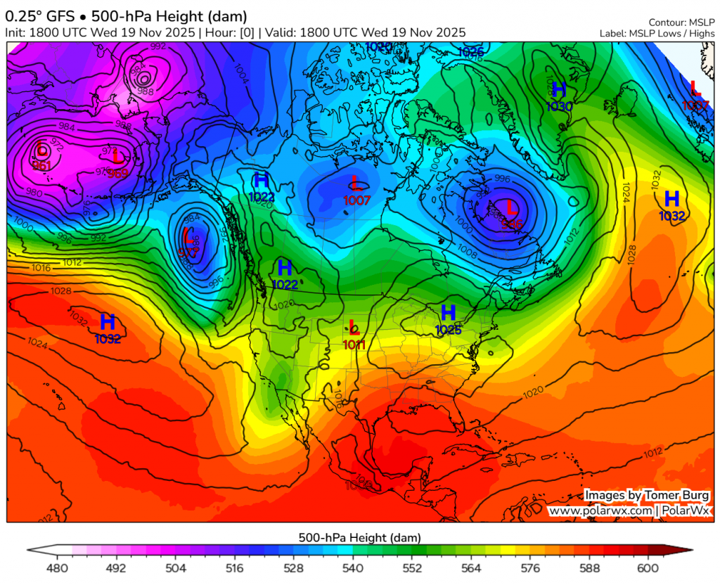
Here’s now:
Here’s a week from now:
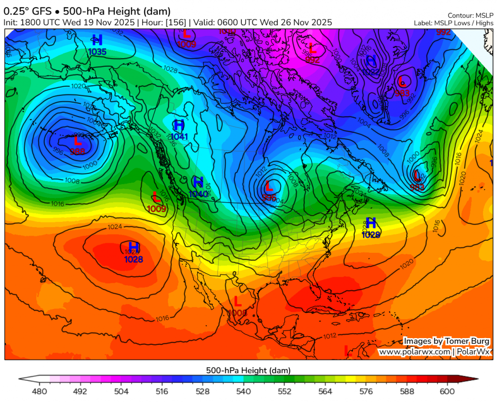
Right now, low pressure dominates in the eastern Pacific, but a large transition will take place around the weekend, where a ridge takes that place. At this time of year, a ridge in the eastern Pacific will disturb the polar vortex (especially when it is weak, like right now), and cause it to rebound just east. This means a sudden shot of cold air. The Pacific ridge will strengthen fast over next week, and keep cold in place for quite a while.
So it was pretty simple why, so next we have to investigate the structure of the cold wave. I would guess starting Monday, temperature will begin to drop, but it wont be very fast. Only a gradual decrease of 3-5 degrees a day. Temperatures will likely stabilize around Wednesday, and stay stable for the rest of the work week.
From the 29th on, models currently diverge considerably, but the main pattern is still on most. Expect a quick ~2 day shot of even colder air, probably bringing the coldest of the cold wave, before a very rapid warmup, staying warm for about another two days, and then a possible return to cold. The exact timing of all this currently varies from starting the 29th to starting the 1st.
During the shot of even colder air, current model differences are generally between -15 and -30 for a lowest temperature.
Now finally, the snow. The begin the cold wave it seems we will have a system move pretty much straight across the entire prairies from west to east. Another system will also come up form the US and interact with it. Here is a map, to help you make sense of this:
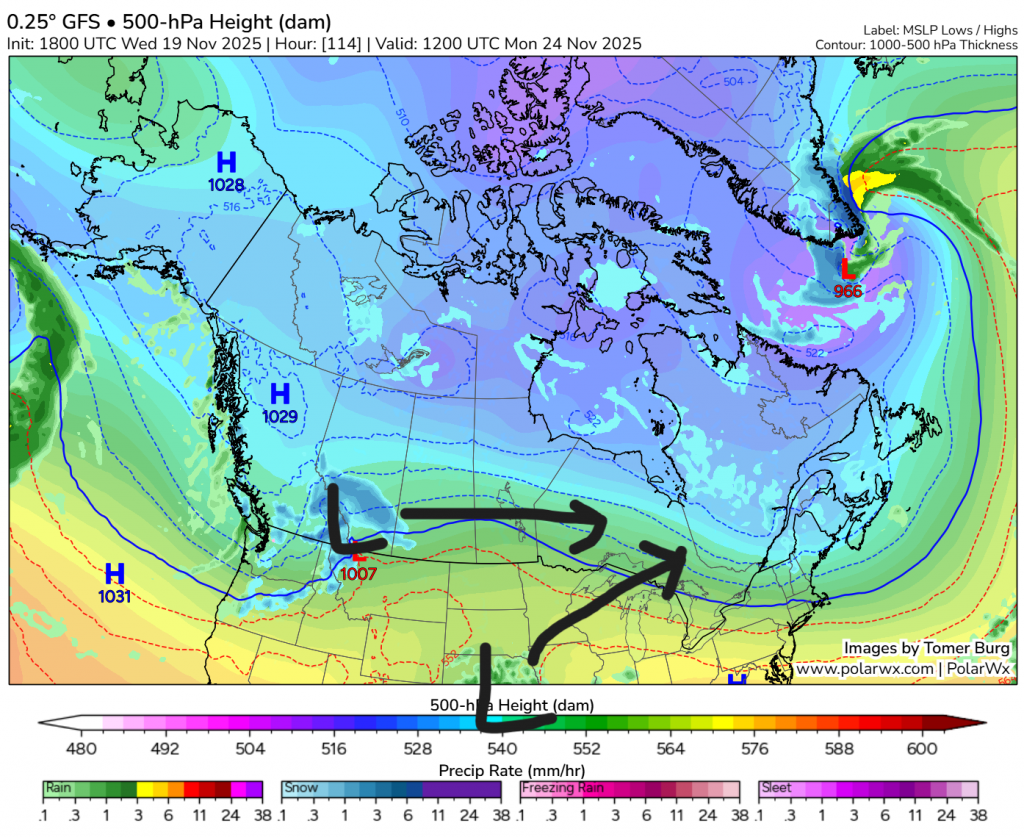
These two lows will interact and possibly merge. If they do, the prairie low will get stalled before, and give us a lot of heavy snow. If they don’t get close enough to each other, then the low will more act as an Alberta clipper, and only give us a dusting of snow. Right now, model differences generally put down between 1 and 10 cm of snow mainly Monday morning through Monday night.
For right now, that is all you need to know. Be prepared for the cold!