
Get ready. Get your winter tires. Snow is coming.
I’ll talk about amounts later, because right now we’re going to dive right into the maps.
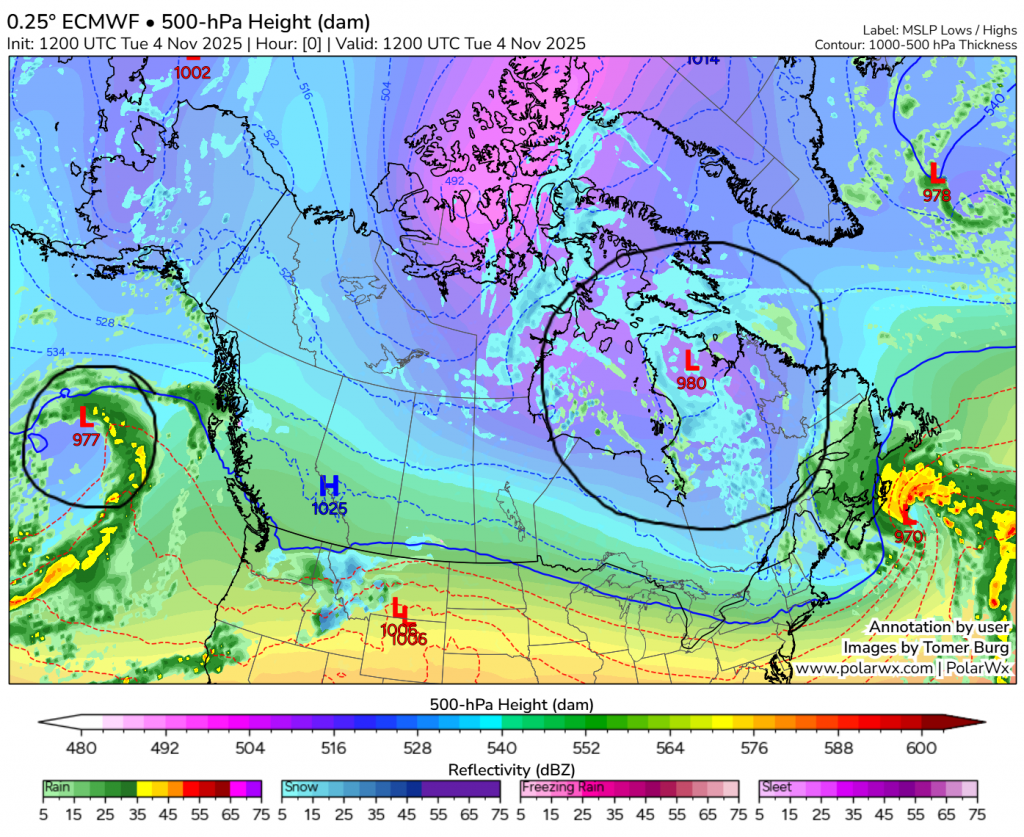
Map #1: This is right now. Overall, the jet stream is quite undisturbed here, but we have prominent troughs in the Gulf of Alaska and Hudson Bay. Those are circled.
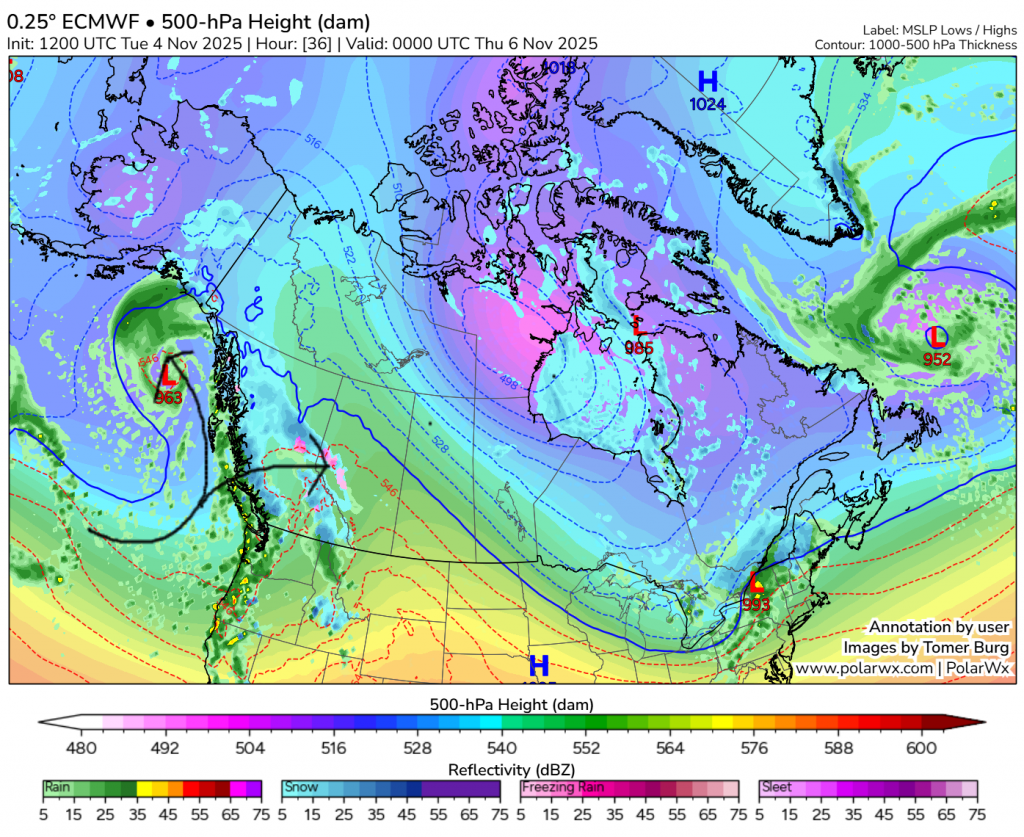
Map #2: Here, we are skipping all the way ahead to Wednesday night, about midnight. As you can see, the Hudson Bay trough is still in somewhat the same spot, and it will stay that way for all the maps. What is interesting is that we can see the approaching low in the Gulf of Alaska get deflected by the mountains, and heads up north to Alaska, but a little chunk of it breaks off. A lot of the recent lows (over the last month) have come the same spot the low was in in the first map, but just sat there for a while before being ushered on over the mountains by the jet extension. This one though is swiftly hopping over the mountains, meaning it will be a lot less moisture-staved than the last handful of these systems, meaning precipitation will be heavier.
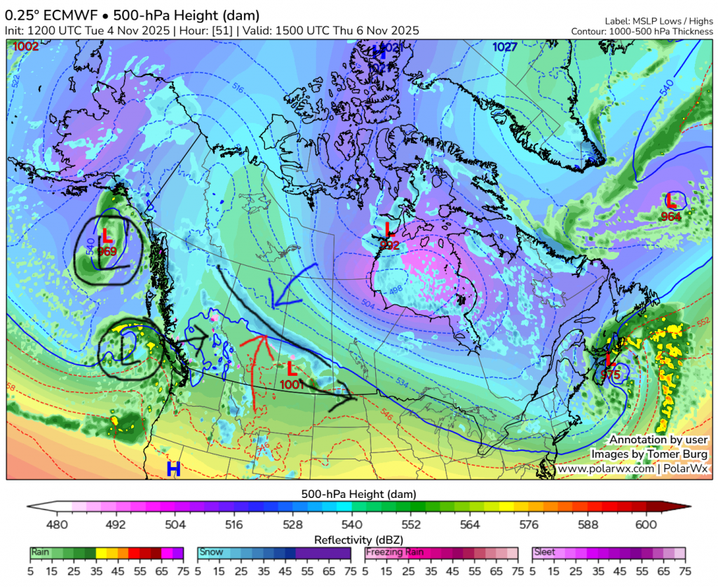
Map #3: Now we are looking at Thursday morning, and we can see the low has already made it to Saskatchewan. We have a long band of precipitation along a stationary front extending behind it, going directly through our area. What is a stationary front? A stationary front occurs when warm air head-on encounters cold air, and the two temperatures create a sharp boundary. Along the front there will be lots of precipitation. This will likely bring quite a bit of snow. We can also see a second wave approaching in the Gulf of Alaska, while the original one is staying in one spot still.
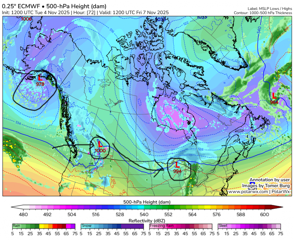
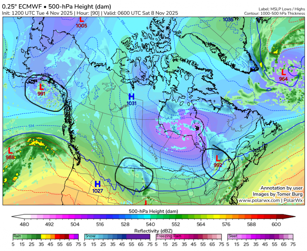
Map #4: We are now looking at Friday, a few hours before sunrise. The original low has moved well off to the east, but the second is starting to give us even more precipitation. There is a lot of uncertainty for this one, but it’ll probably give anywhere from a light topping to ~5 cm, though maybe a small chance of more.
Map #5: We are now all the way out at Friday night. For the most part, the second low has exited, though a few flurries may still be left behind.
So, our overall timing is a lot of snow Wednesday evening through Thursday evening, but if temperatures are warm enough, some of that may fall as rain. A short break between lows Thursday night, then another likely lighter round on Friday, with a lot more uncertainty on how much it will give.
Now, it’s time for amounts.
We will start with some websites. Environment Canada says 11.3 cm, AccuWeather says 5.5, and The Weather Network ~10. Next, major models. ECMWF says 16 entire centimetres, and GFS and AIFS both say 5. For some other models, RDPS says 17.3, GDPS says 15.6, GEPS says 12.9, and NBM says 12.
Key: European Centre for Medium-Range Weather Forecasts (owned by EU), Global Forecasting System (owned by NOAA), Artificial Intelligence Forecasting System (owned by ECMWF), Regional Deterministic Prediction System (owned by ECCC), Global Deterministic Prediction System (owned by ECCC), Global Ensemble Prediction System (owned by ECCC), National Blend of Models (owned by NOAA).
It seems the general consensus is 10-15 cm, with the possibility of it being lower, more around 5. Why is this? It all depends on that stationary front, and how there is a bit of uncertainty on where it lands. If it ends quite close to us, we will get 10+. If it’s something farther north, lower than that.
There you go, all the information we know right now. Tomorrow would be a good time to change to winter tires and finish any yardwork if you haven’t already. If we don’t get little, this snow will probably not melt until spring! I will post updates on Element for more up-to-date information on amounts tomorrow. One more thing to note; if the certainty increases towards a lot of heavy snow, a snowfall warning could be possible.