
Tomorrow afternoon, evening, and overnight; we will have very good chances at severe thunderstorms. Today, we have a chance at a thundershower, though it isn’t really too much of a chance. We might only get a quick shower this evening, if anything. As we look towards tomorrow though, instability will become way way higher. Here is a surface analysis chart with some overlaid stuff I’ve out on it. It is from noon today.
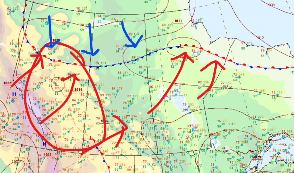
As you can see, we have low pressure over Alberta (the red circle), as well as a very long frost going off the the east. The red arrows are warm air, and the blue arrows are cold air. If you know anything about what causes storms, you would know they need instability in the atmosphere, and the usual cause for this is a clash of warm and cold air. So as you can probably infer, the area around the stationary front in northern Alberta is where we’ll see the most storms today. The most common cause for storms here is warm air flowing over the Rockies, which causes lots of instability and storms generating in foothills before moving off through the prairies. It might seems like that is happening here, but there’s one problem. For the storms to actually move anywhere, they need the help of the jet stream. Currently it’s tied up in being a ridge right now, so the storms can’t move eastward. This means we probably won’t see any storms today, maybe only if a local cumulonimbus pops up.
Next, here’s what is expected for tomorrow at noon, overlaid with the same map:
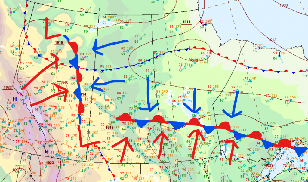
As you can see now, we have mainly two lows, with lots of warm and cold air mixing over central and southern Alberta, central and southern Saskatchewan, and southern Manitoba. The low we’ll be looking at is the southern one. Around here, there will be lots of moisture, meaning on mostly the northern side (because that’s where the stationary front is) there are very good conditions for severe thunderstorms. This low is actually going to move northward very slowly through the day and night on Sunday, meaning from mid afternoon tomorrow to overnight tomorrow night, we have a quite prolonged chance for severe thunderstorms.
In wake of this, starting on Monday, we will probably see good chances for thunderstorms every single day next week, since the jet stream will be near and instability holds.