
It’s been a while since the last short-range forecast. Actually almost a month. Today, the drought will finally end, as some very, very cold temperatures are coming over the next few days, with a good amount of preceding snowfall.
Part 1: The snow. Starting likely within an hour or two of midnight tonight, some snow will start. It will be very steady, and possibly quite heavy and visibility-reducing. The reason for this is a low moving through southern Alberta, and a band of precipitation extending northward up until about the latitude of Peace River. Windy.com is the only website I know that shows HRDPS (High-Resolution Deterministic Prediction System, very high-res model operated by ECCC. It is the best for these kinds of precipitation situations) maps. For some reason, nowhere else it is shown. So, here’s a map from it:
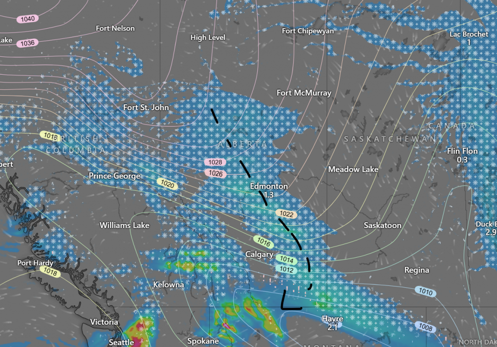
This area of snowfall will be quite heavy, but certain east-west bands may become even heavier, so though most forecasts put down something in the 3-6 cm range, a lot more cannot be ruled out. This snow should be mostly over by sunrise.
Through the isolines on the map, we can see a lot of this precipitation is attached to a ridge, coming up from a large thermal high in the north. This will be bringing down extremely cold air.
Part 2: The cold. After this area of precipitation leaves, air even colder than the stuff we have right now will rush in and try to battle the normal daytime warming, and it seems it will be just close enough to keep the temperature almost exactly the same from sunrise to sunset tomorrow; somewhere around -22 or -23. As a very cold high pressure system approaches from the north, skies will clear and winds will (partially) subside. This creates the perfect conditions for extensive nighttime cooling, and with the temperature already starting at -23, we will be plunging into quite the deep freeze.
Through the evening, temperatures will drop to most likely somewhere between -28 and -32. Even with the very minimal winds, wind chill values will be approaching, if not just barely succeeding -40. -40 wind chill is definitely enough for a yellow cold warning, so one will probably be issued sometime tomorrow. To mention are that some models are seeming to be “sticky” with the low being significantly away from -30, wanting to stay around -26 (Environment Canada, mainly) or -35 (A few Canadian models). It’s on every run for these models, while all the others stay near -30.
Well there you go. That’s all I have for you. Stay warm, and don’t get frostbite!