
Happy December! For a quick version of the upcoming forecast, we will be probably quite snowy with a lot of temperature variation and uncertainty.
If that’s all you came for… Well, bye I guess? For the rest of you, read on for details.
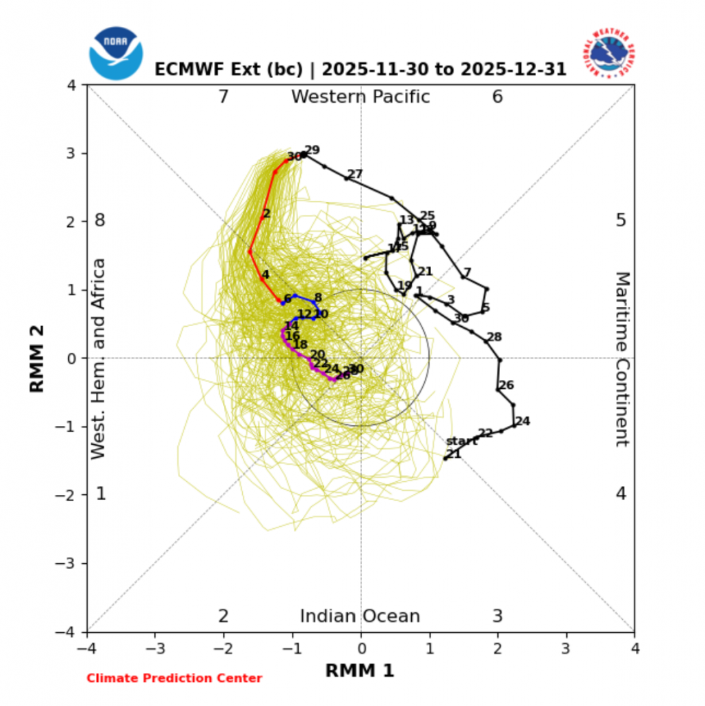
This month, what are the overarching oscillations that will likely affect us? First of all, La Niña.

As you can see, we are currently at a -1. Since September (actually even earlier) It has been very slowly strengthening, but in the last week has started to weaken. I would expect the -1.2 we got about 5 days ago to be the peak of this year’s La Niña. Towards the end of winter, we might actually end up pretty close to neutral.
Related to this, we have the Indian Ocean Dipole. For a while now, it has been a battle between the two, with La Niña’s easterly winds and the negative IOD’s westerly winds meeting in the middle and causing the MJO to be stuck in phases 4-6. Why is this? The MJO is just a question of where is rising motion in the Indian Ocean and west Pacific near the equator. Around Indonesia is Phases 4-6. 7/8 is the west Pacific, and anything below 6 is in the Indian Ocean, with 1 being almost at Africa. The converging winds are just causing the rising motion.
The Indian Ocean Dipole has been quite negative for a while, but in the last two weeks weakened extremely fast and is now near neutral:

Finally, the MJO. It seems the expulsion of westerly Indian Ocean winds will cause the MJO to shift to more Phase 8, then slowly dive. These phases are usually bringing of cooler, more active weather than 4-7.
Now for the actual forecast. This week, temperatures are varying a lot, and a lot of snow is forecast. Both of these are likely good analogs for the entire month.
Here is a good graph for a bunch of different models and their temperature forecasts:
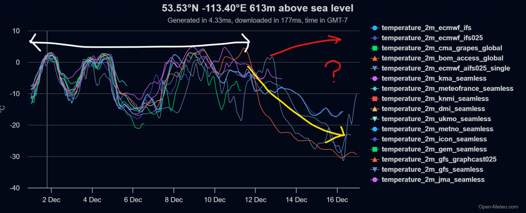
Everything under the white arrow is somewhat certain. You can get a good look at what temperatures will likely do over the next while. Throughout at least the next week will be very active and snowy, and there are currently no signs of that stopping soon. After the 12th, the models suddenly take the temperature way down, but that’s not for sure. What the red means I will get to soon.
Now, what is the pattern governing the above graph? For this week, it is this:
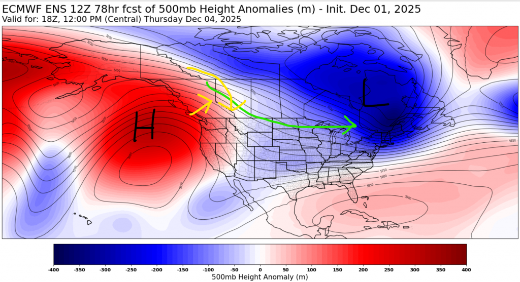
On this map, the yellow is the surface wind direction, and the green is the storm track. We have cold air the north and east, and warm air to the west and south. The barrage of lows expected to pass through over the next 5 days will create great day-to-day temperature variations.
Next up, the second week of December:
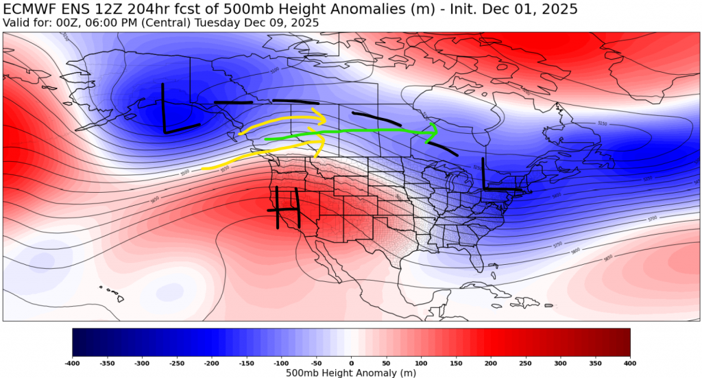
Now what we see is that the high has snuck into the US and cooler air stretches in a band from Alaska to the Maritimes. We will likely still stay active, and also more windy.
Around the 12th, we see a divergence. A lot of operational models but a big blast of cooler air down. The most aggressive of these right now is the ECMWF artificial intelligence model, AIFS:
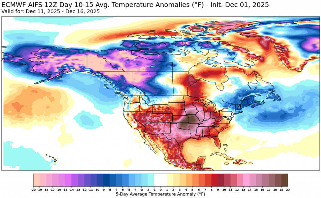
It’s in Fahrenheit, but that difference from normal for us would be around 7 degrees below normal. That would likely mean lows getting close to (or maybe even beyond) -30, as events like these get amplified as they near.
The other side to this are the sub-seasonal models. They give us a heat wave and focus all of the cold in the east. The is a map for December 10-15:
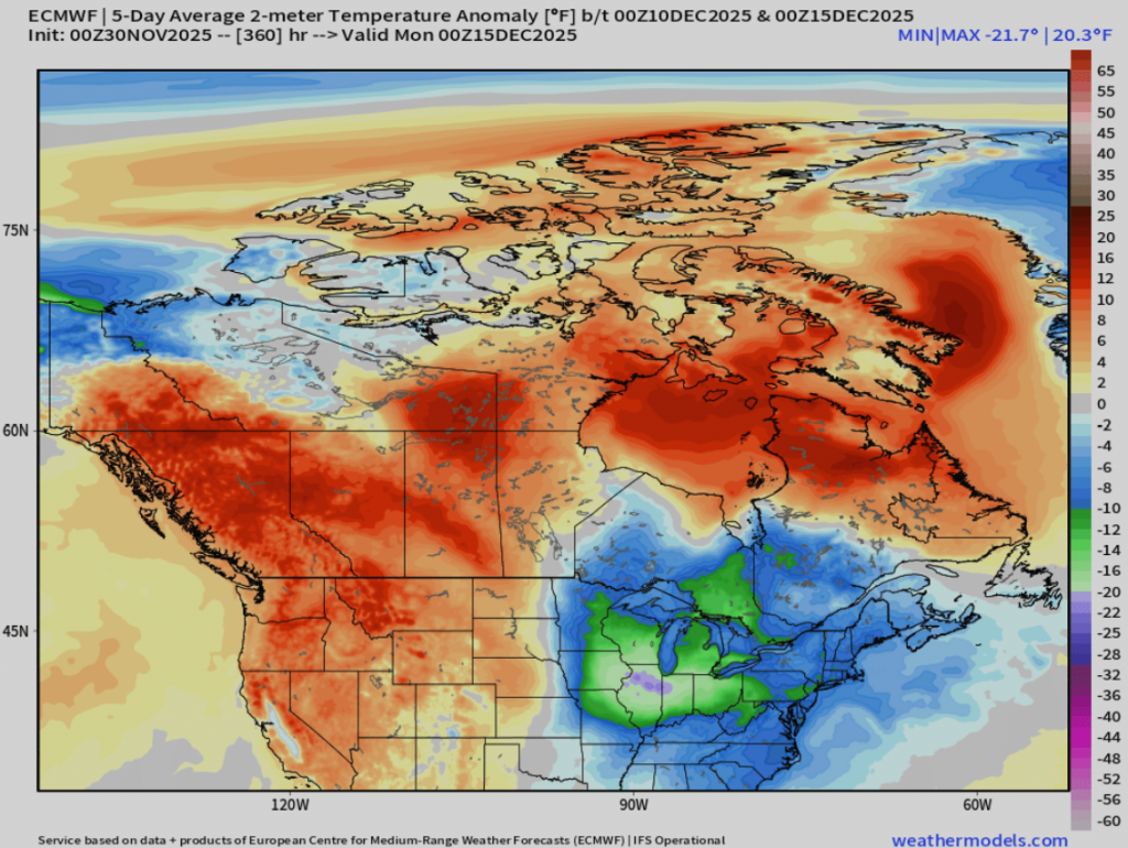
This puts down much warmer air. Note that it does not stick; but rather these models put a blast of cooler air from the beginning of winter break to the beyond the end of the month.
As well, both the operational and sub-seasonal models have high amounts of precipitation, despite the temperature differences. I would say it is more likely that we have a snowy month, but that doesn’t mean it will be. Entire seasons often get characterized by just one or two events, or lack thereof.
So, our final prediction for December is:
Variable, but mainly cooler temperatures, and most likely lots of snow.
That’s it for now, thanks for reading!