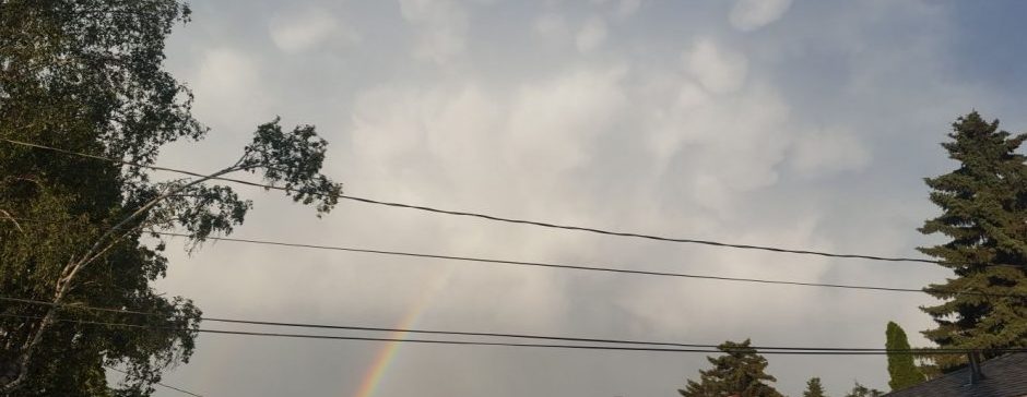
Get ready, we have temperatures near record-breaking values, very strong winds, and even snow.
This morning, a cold front came through. This brought sustained winds of 32 km/h, gusting to 57. As well, there was some rain, which created the best rainbow I had even seen this morning, though that was likely a very local thing. We have a low currently in northwestern Saskatchewan, with a cold front trailing down to near here, and a bank of clouds northwest of that moving to the northeast. We had a small protrusion in the cloud that gave us the rain this morning. The low is quite deep, with its lowest pressure being 990 hPa!
Over the day today, we’ll be dry most of the time, with maybe to occasion short pulse of heavy rain, like we had this morning. Strong winds averaging 20 km/h, gusting to 50 will be present today coming from the northwest, as winds wrap around the backside of the low. Later today, the rain will head off northwest, and precipitation chances will drop from 60% to more like 20%. However, there is expected to be some snow in the Rockies starting tonight, which will spill out into the foothills, and possibly all the way to us. A very light, non-accumulating flurry could happen anytime overnight or tomorrow morning, but the most likely time is 6-8 am.
Now, back to temperatures. We were 15 degrees at 7 am, but now we’ve dropped down to 12. When will the temperature turn around so we can get a normal afternoon high? Answer: Never. The temperature, will keep dropping, and by sunset tonight we’ll be around 5. The temperature will keep going down through the night, and we will end up at a low around -2. The temperature will go up a small amount tomorrow afternoon, with a high around 1, but the temperature for tomorrow will stay within a degree of 0 for over half the day.
For winds, we will stay at 20 gusting to 50 for next 36 hours, while winds might shift to more straight northerly. Tomorrow night, winds will die down, and by Monday morning we will be calm, besides the remnant marginally strong gust. The mostly cloudy to overcast sky that will engulf the next 36 hours will as well start to break down tomorrow night continuing into the Monday, with a likely clear sky Monday night. Tomorrow night and Monday night the low will be around -5, and on Monday the high will be 1-3 degrees warmer than Sunday.
Okay, that all I have for you. Now you know what’s coming this weekend!
