
A lot is coming in the next week, in weather, but also this blog. Get ready for an August and September recap, preliminary 2025-26 winter forecast, and 2025 wildfire season recap, as well as the normal one medium-range forecast (this one) and 2 short range. This one is about a very strong cold wave on the way this weekend, which may or may not end up continuing for a while.
Let’s start with right now. Here is a surface analysis map.
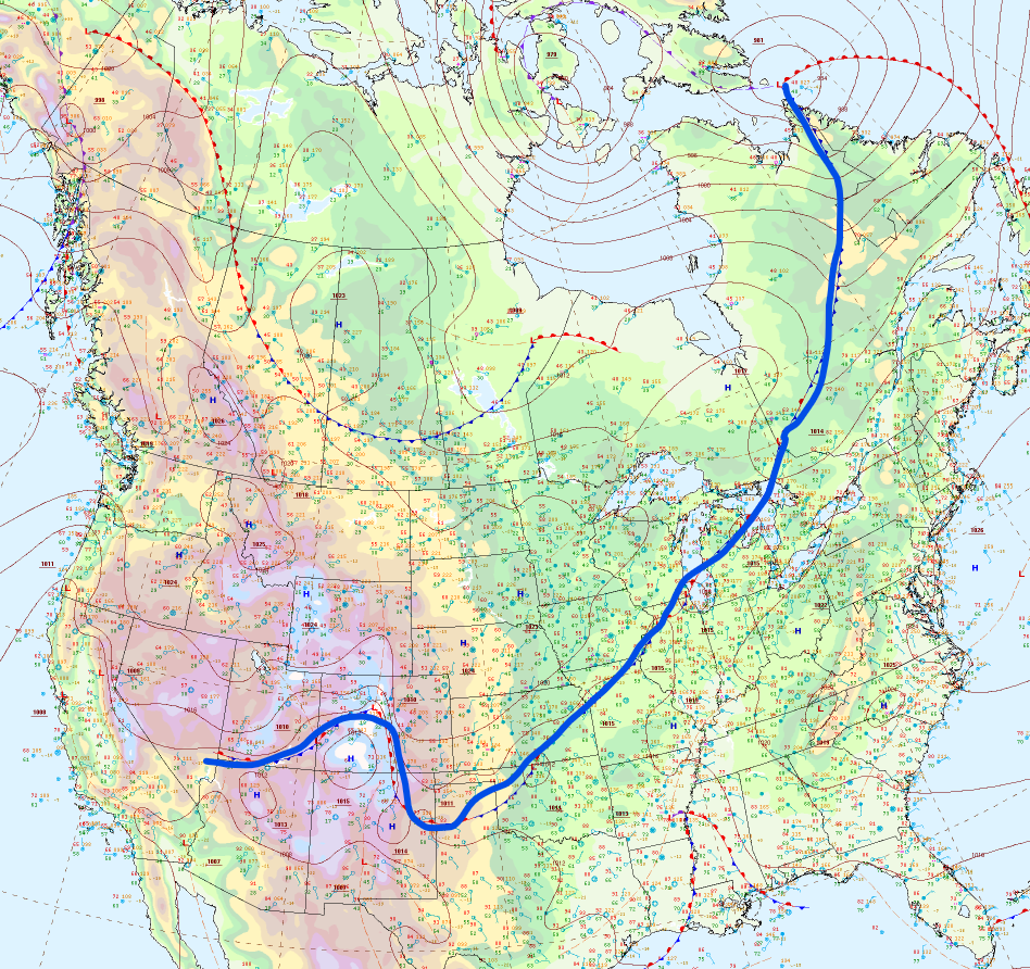
That blue line is a cold front, actually the same one that came through over 50 hours ago on Saturday morning. You can see on the map it is connected to a low around the northern tip of Labrador, and there is also another low a little to the west of it. That is a trough.
Now, let’s go to the forecasted current conditions from the GFS model run this morning.
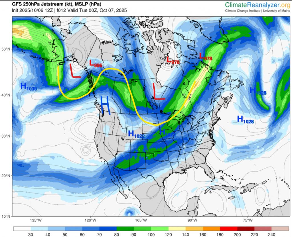
You can see the same two lows, and the big trough in the jet stream. I also marked a high and two lows that make up on omega block we have right now. This isn’t a strong one, and it’s also moving. As you can see, we’re exiting a trough, (which was the one that brought -3 on Saturday night) and we’re entering a weak ridge.
Now, I’ll jump ahead all the way to Wednesday night.
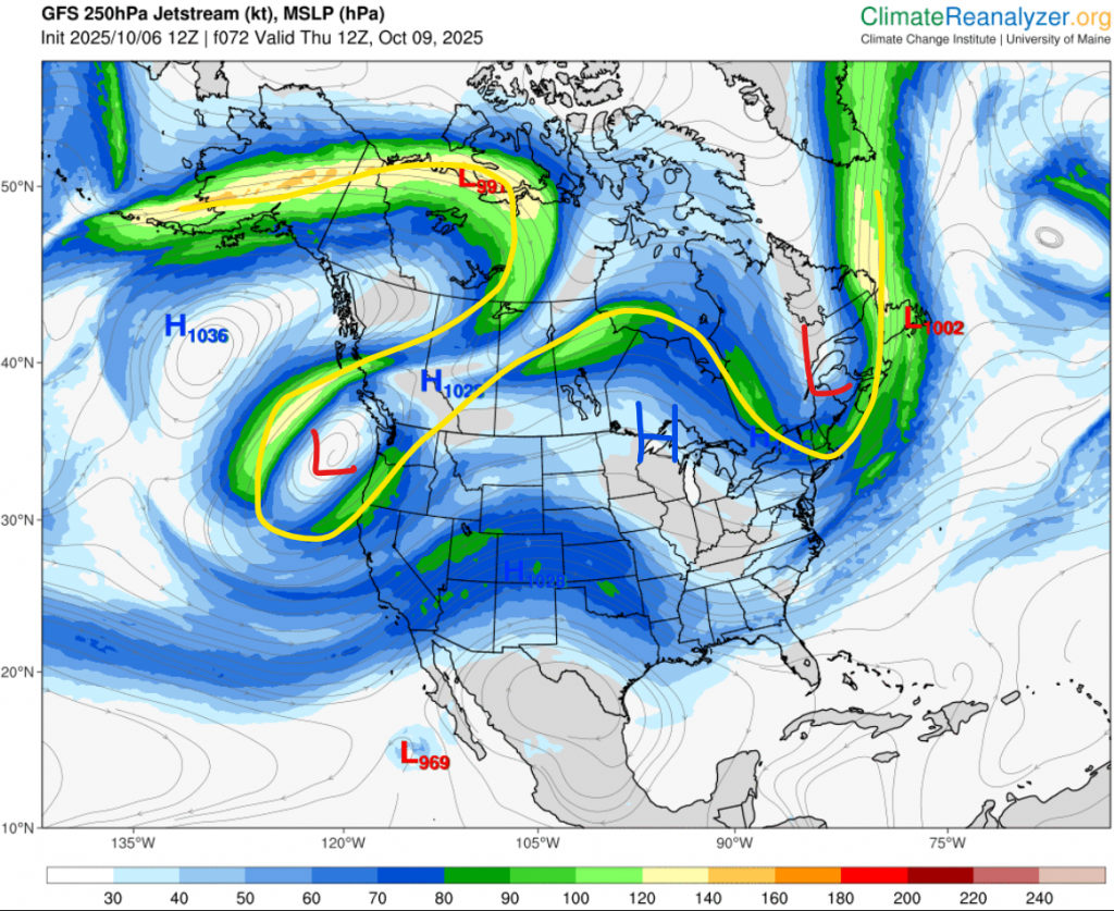
I marked the same highs and lows as before, so you can what’s changed. As you can see, the omega block moved east, but the west low is breaking off. This is not a rare occurrence, but actually the normal. When an omega block travels from west to east over North America, the westerly low will almost always break off. For us this week, it means we’ll get a short shot of slightly below average temperatures on Wednesday, before we warm back up again as the low completely cuts off.
It is not until Friday night, when something very interesting happens. Here’s the map:
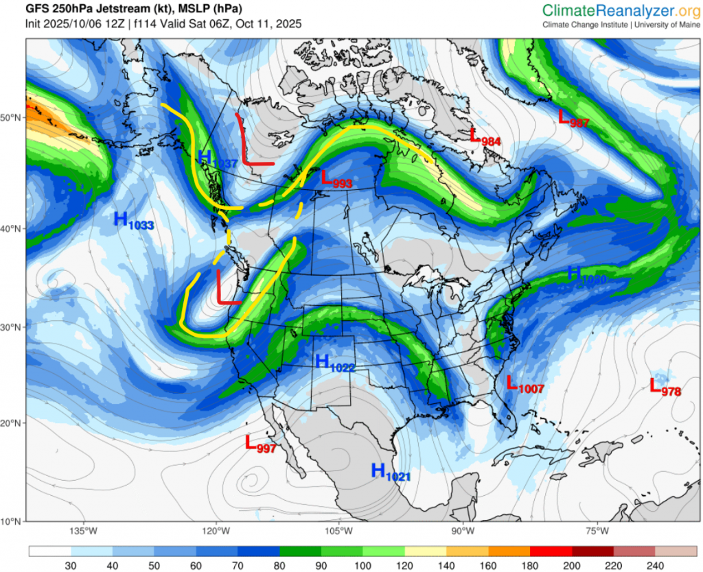
As we can see, a new trough has come over from Asia, and is starting to interact with the cut-off low. Once they get close enough, the low reconnects, and a very deep trough is created, which will drop temperature from near 20 to negatives in only 36 hours.
So here we go, the forecast for the cold wave. Let’s start with Environment Canada. Currently it’s saying a high of 16 on Friday, low of 3 Friday night, 7 Saturday, -2 Saturday night, and 4 Sunday. Accuweather, starting on Friday’s high is 21, 4, 10, -2, 2, -5, 6, -3, 9. Finally, The Weather Network says 17, 8, 10, 1, 3, -2, 6, -1, 7. So overall, the website forecasts are agreeing the coldest day will be Sunday, with a high of 2-4. Now for the models.
Still waiting on the update so this can be in Celsius. Overall here, we’re agreeing on more near 0 highs for both Sunday and Monday.
Now what about precipitation? There might be some, but probably not a lot. It seems a front will probably give up a bit, but the main low will pass south of here. The timing currently is “probably just Saturday.” If we get any precipitation in the night, then we might just get our first snow!
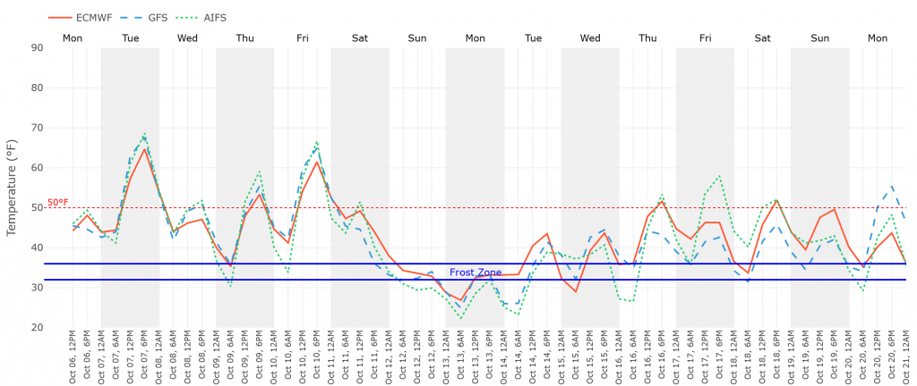
The title did say “MAYBE extended,” so what’s that about? Most forecasts are thinking after Monday, we’re going to return to near-to-above normal temperatures. However, there is one interesting outlier: GFS. If you look back up to the graph above, You’ll see it. The average high for that time is around the red line, but you can see GFS in blue is well below that. So what is going on? Well, I dug into it, and it’s really complicated.
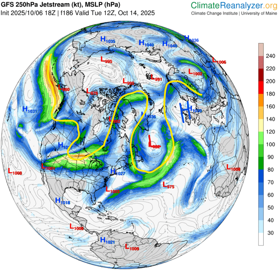
It seems the thing this model is forecasting is really big blocking high appearing over Europe. If the model is right, this will block the trough we’re just exiting now from moving east after it travels in the Atlantic. That is the low you can see in the picture. Because of this immense block, the jet stream erupts into chaos in eastern Canada, and our trough coming this weekend doesn’t really have anywhere to go, so it kind of just stays here.
This is only one model, and no other have caught onto it yet. Maybe it’ll disappear in a day or two, or maybe an extended cold wave will manifest. We’ll just have to see.