
Back on Wednesday, I said that there was a possible larger heat wave coming this week into next week. So, this week is this week, meaning it’s time for an update.
For the next few days, not much has changed since then. We still have the low sneaking its way into the Gulf of Alaska. We still have a blocking high in the southern US which is ridging up to here. The main thing that has changed is what happens after Thursday.
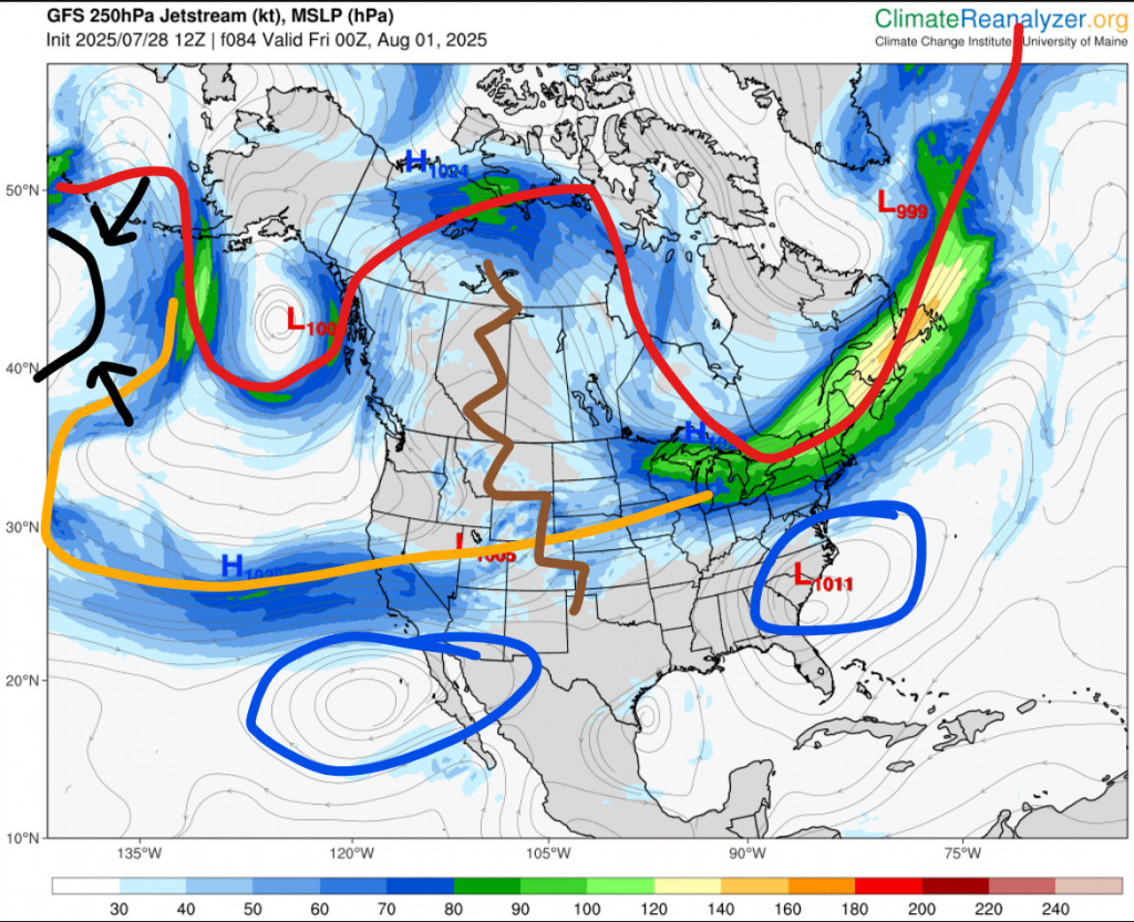
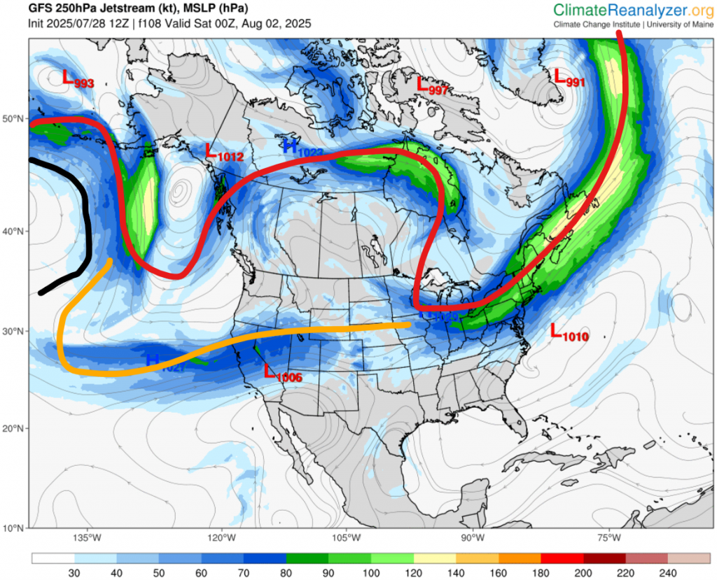
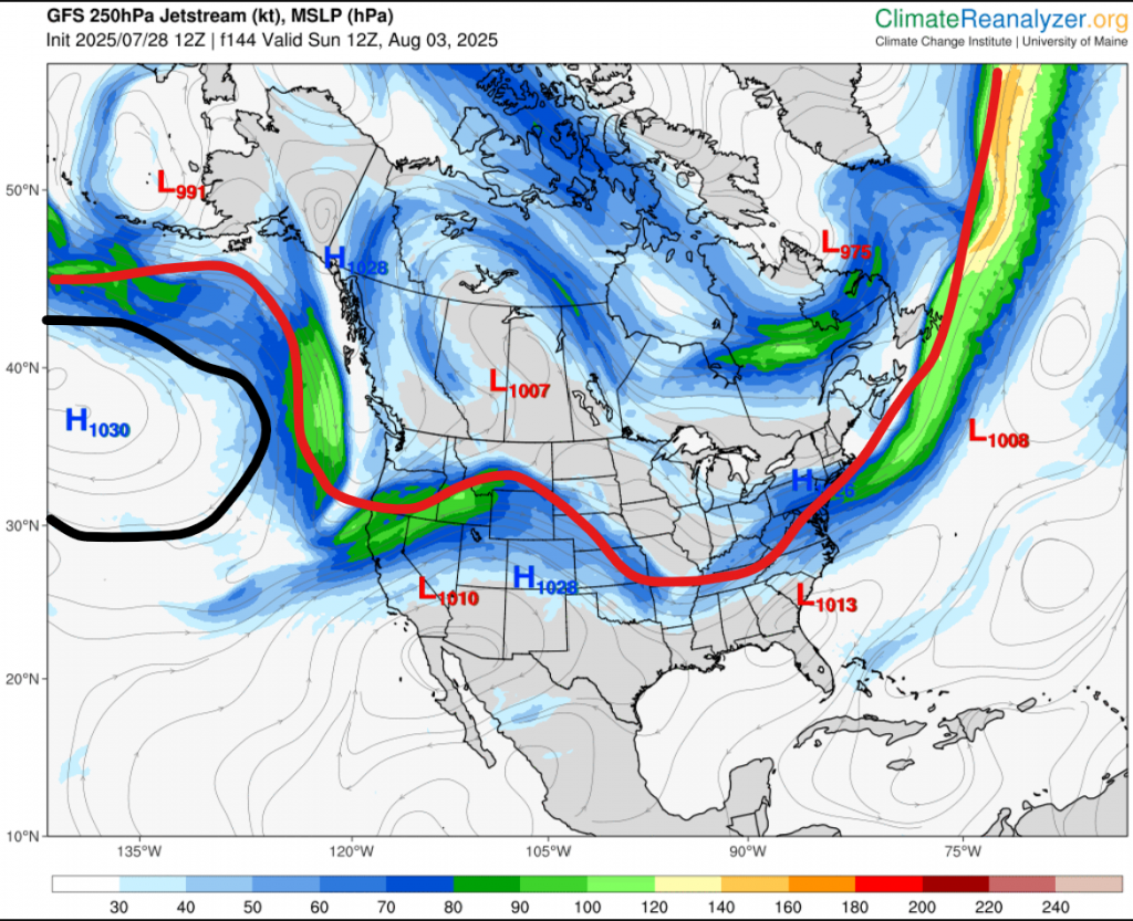
First of all, let’s look at Thursday evening, which is the first picture. I have laid out where the polar jet stream and subtropical jet streams are. You can see the classic omega block pattern. At this time we have not one, but two blocking highs below the subtropical jet stream, which are collectively enforcing a ridge (zigzag line) up to Alberta. What I really want you to take notice to though is the Pacific high. That is the one on the left with the arrows pointing to it. Now, look at the second picture. This one is for just 24 hours later. Notice anything different about the Pacific high? Yes, that’s right. It’s expanding to the west. If you go to the third image, this time on Sunday morning, you can see the jet stream has gone way south and we are now in a cold wave.
Next, let’s move to what the actual temperatures may look like during the heat wave.
| Expected high | Expected low | |
| Monday | ~20 | Low teens |
| Tuesday | Mid 20s | Mid teens |
| Wednesday | High 20s | Mid to high teens |
| Thursday | ~30 | High teens |
| Friday | ~30 | Mid teens |
| Saturday | Low to mid 20s | Mid teens |
Finally, precipitation. Besides today, the work week looks bone dry. Only when we get to Friday night there are some possible showers and/or storms.
If you want to know what next week and beyond will be like, then you won’t have to wait long! I will post an August outlook later this week.