
Today the temperature has reached a high of 25, which is above seasonal, but not by much. However, tomorrow the temperature is forecast to reach 27-33, most likely 30 or 31.
The reason for this? Well, if you look at the map below, you can see what’s going on. There is a low in northern Mexico that is expected to push the subtropical jet stream (blue) northward, which in turn sparks a ridge in the main jet stream (red). An upper-level low in northern BC will then fuel this spark and create a upper-level ridge over Alberta and Saskatchewan.
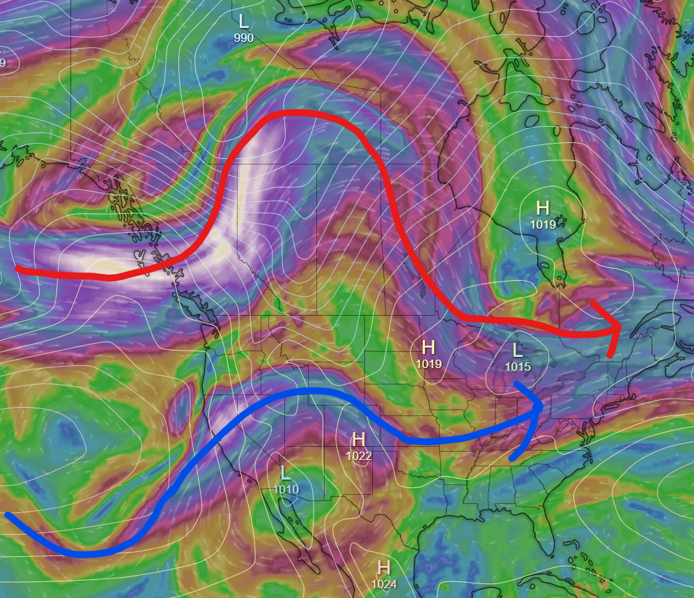
(By the way, this map is for Tuesday night, about midnight.)
July 8th has one of the lowest heat records for July, meaning that we will be getting pretty close to it. I would say it is relatively unlikely that we beat 32.6 degrees, but it is still a possibility.
After tomorrow night, the temperature will take quite a plunge, with a high a few degrees below seasonal set for Wednesday.
<3